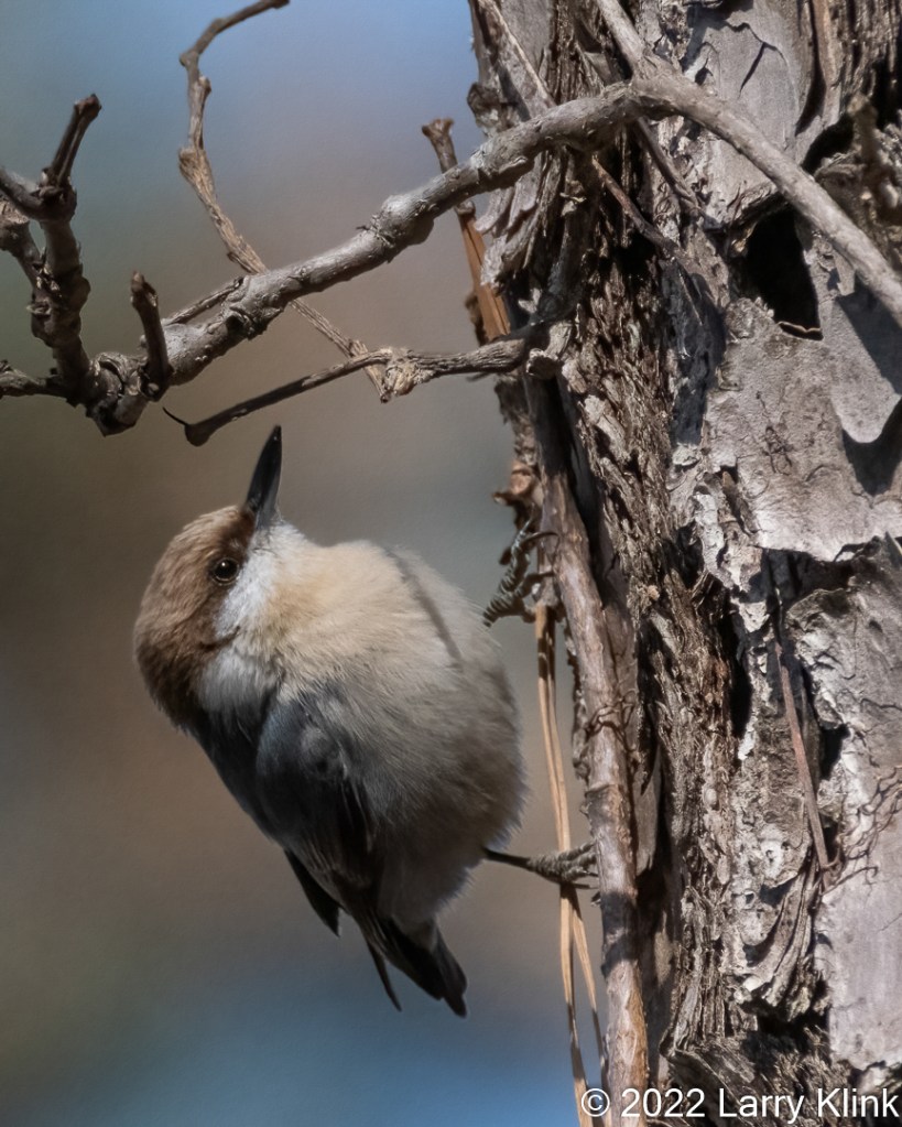
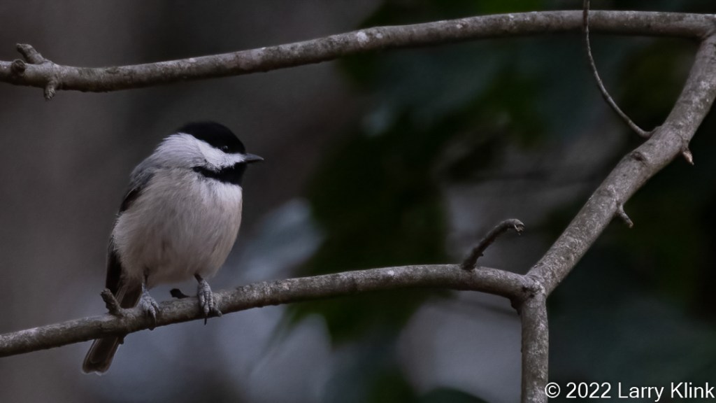
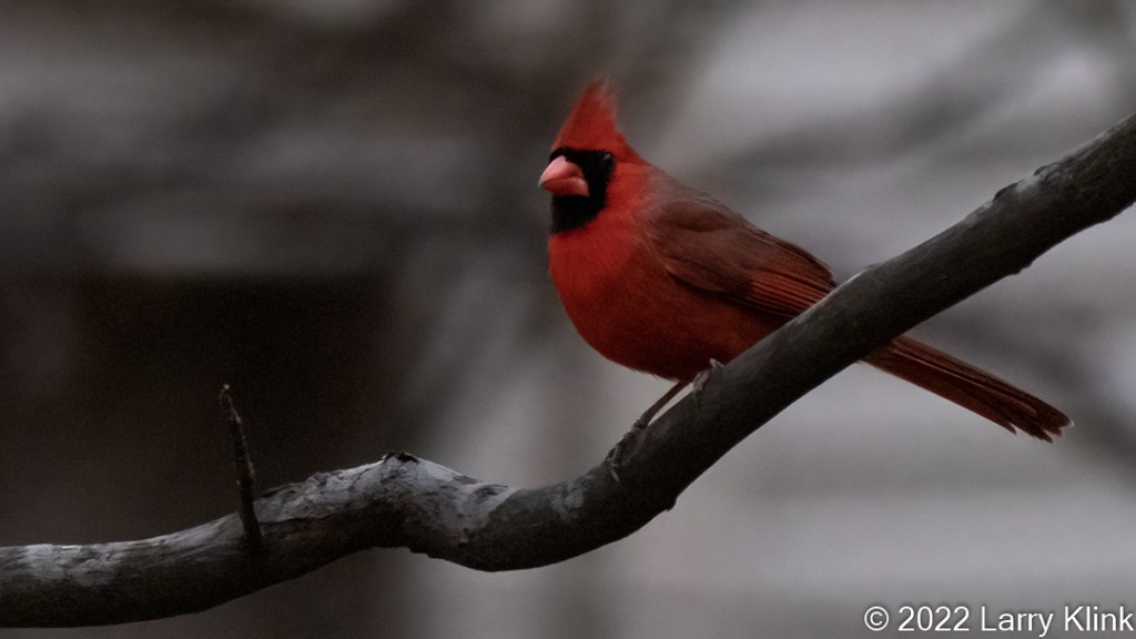
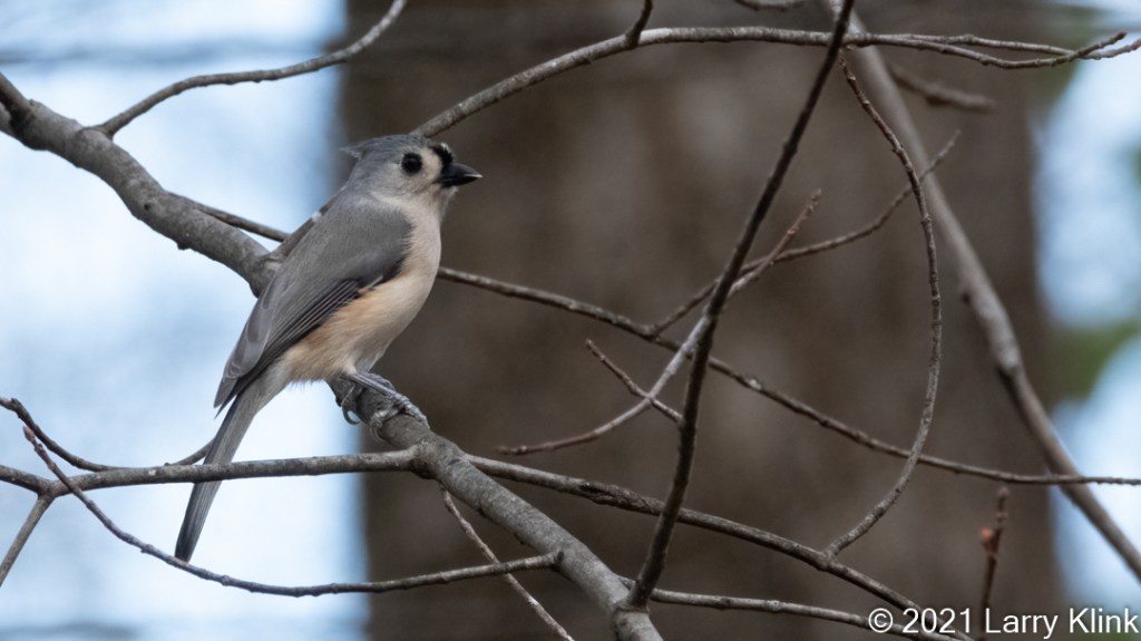
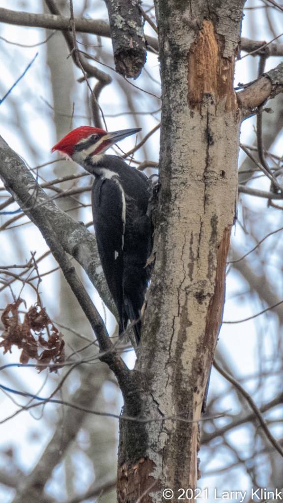
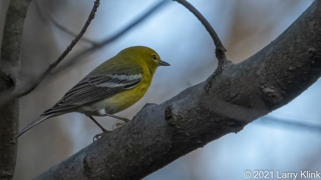
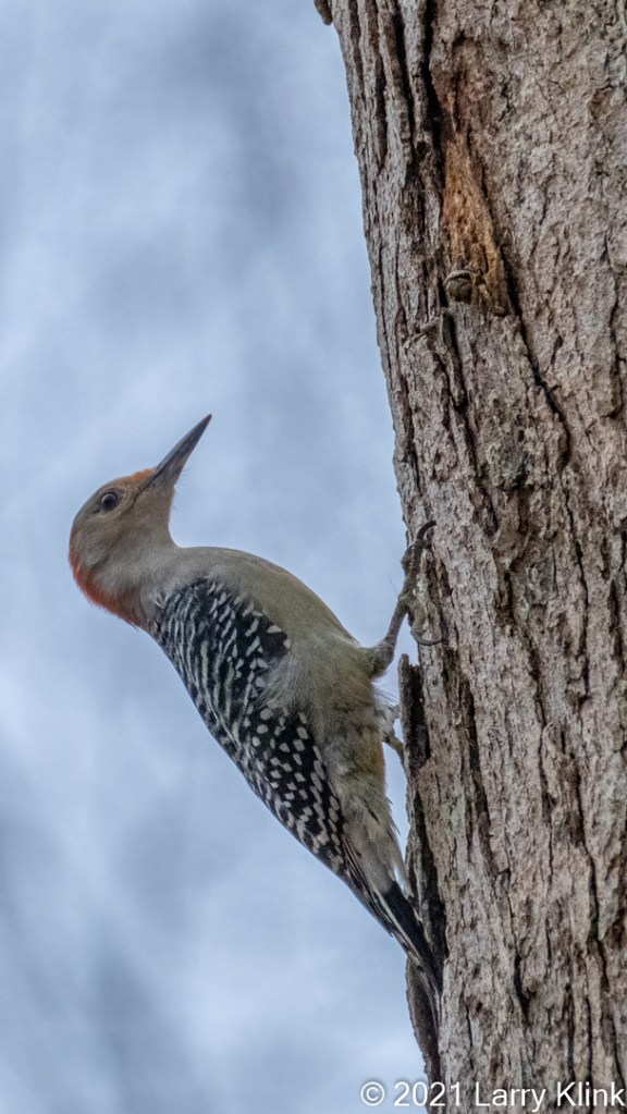
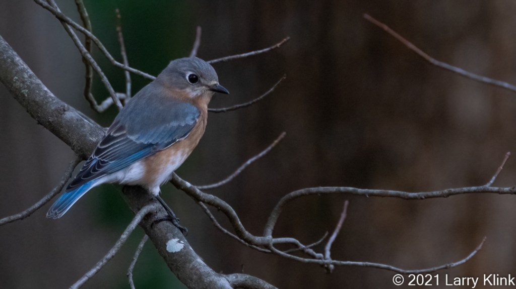
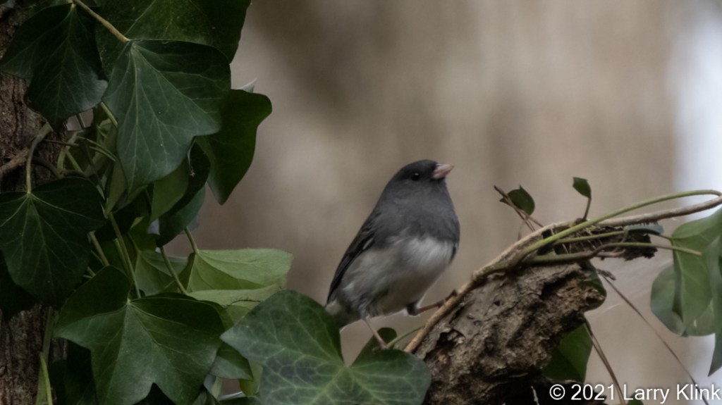
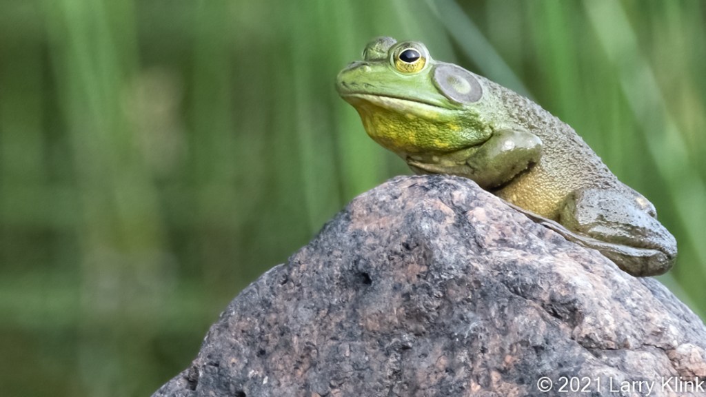
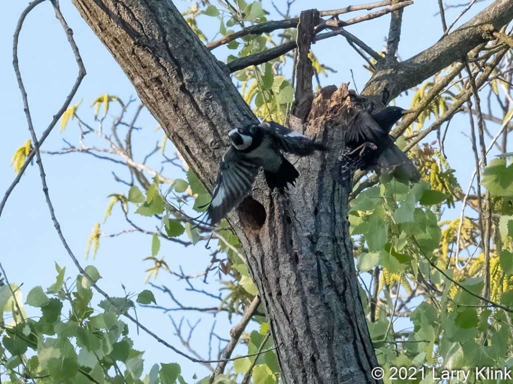
This week, I’m sharing a few more backyard birds from our new home. I’ve learned few some things. The tufted Titmouse behaves like the Oak Titmouse we had in California. It comes to the feeder takes one seed then flies away. The Carolina chickadee’s pig out; those tiny birds are always at the feeder.
If anyone would like a copy of almost any picture in my library, for educational or research use, please contact me and I will happily share a digital copy with you.
I’ve taken a nearly 3-month hiatus from posting. Not because I needed a break, but, because we have relocated. We left Sacramento and moved to the northeast corner of the Atlanta area. We have a nice ½ acre property that is heavily forested, with lots of birds. I hope to get back on track over the next few weeks and post regularly. For those I follow, I’ll be back enjoying your blogs also.
Here are a few of the birds I’ve been able to photograph in our backyard.
If anyone would like a copy of almost any picture from my library, for educational or research use, please contact me and I will happily share a digital copy with you.
Please visit my website, www.earthwatcher.us to see my collection of landscapes and wildlife.
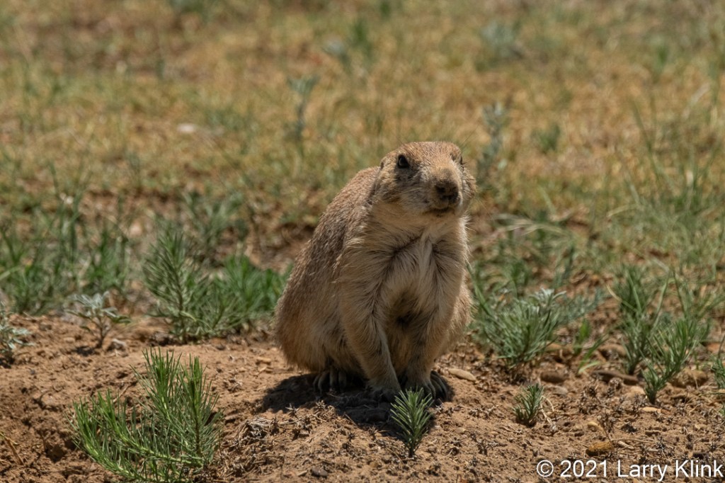
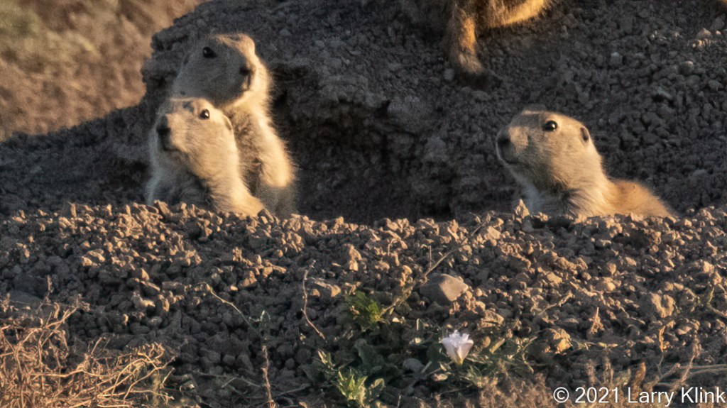
On our trip last July, we spent some time observing Prairie Dogs. I was fascinated by them, just as I am with many rodents. They are very observant and industrious creatures.
Please click on caption to see images in higher resolution!
If anyone would like a copy of almost any picture in my library, for educational or research use, please contact me and I will happily share a digital copy with you.
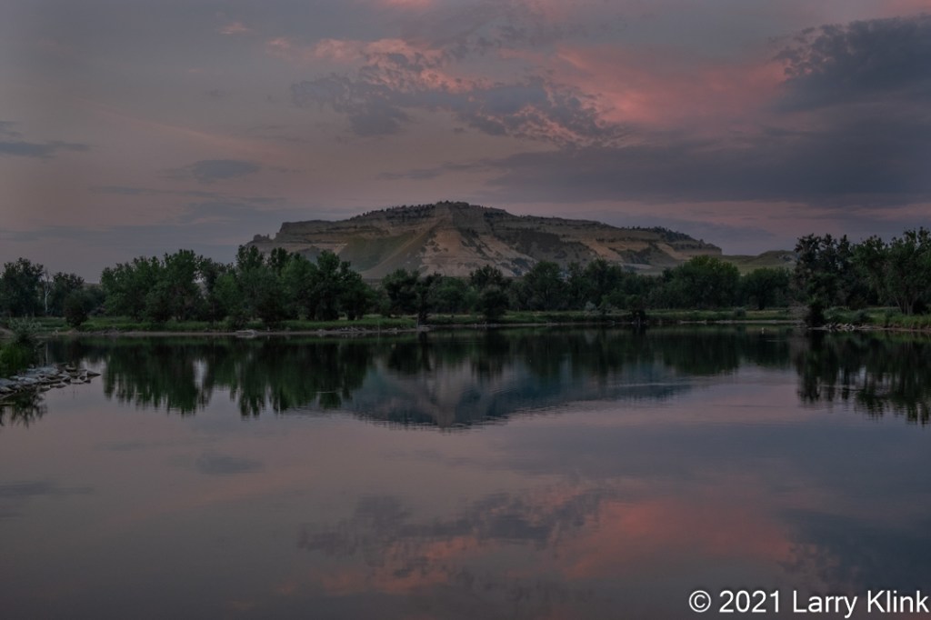
Scottsbluff National Monument is a small butte, with a small surrounding grassland, in Gering, Nebraska; next door to the town of Scottsbluff. The monument is one of many buttes in a broad valley. The valley eroded away leaving the buttes standing. The North Platte River runs through the valley and next to the monument.
Please click on caption to see image at higher resolution.
If anyone would like a copy of almost any picture in my library, for educational or research use, please contact me and I will happily share a digital copy with you.
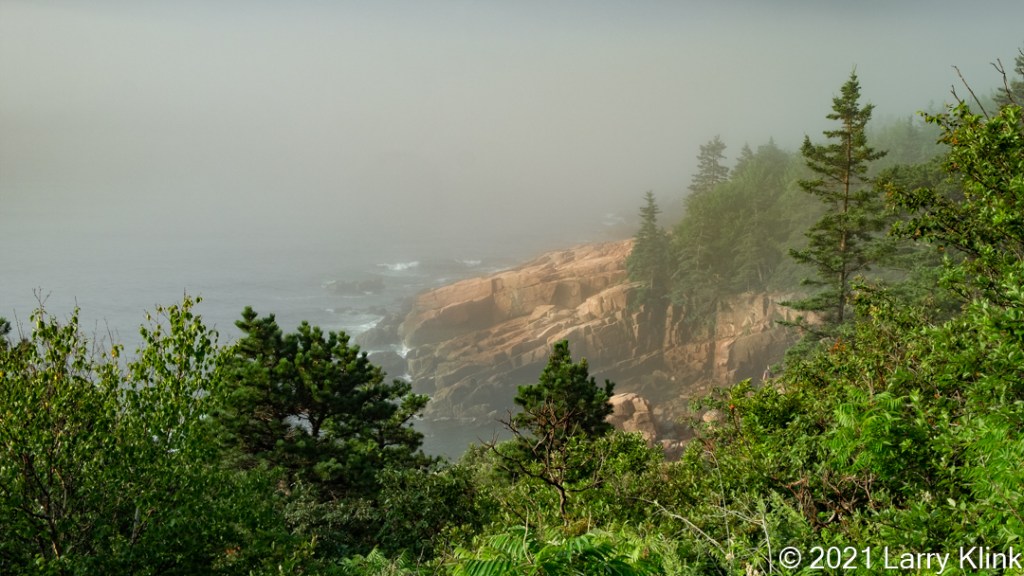
We recently visited Acadia National Park. Overall, I liked the park, but the area had more of the feel of a beach resort than a national park. It is served by Bar Harbor ME, a typical tourist resort town.
The Park Loop Road is a beautiful ride but much of the coastline is obscured by forest. There are several trails and if I ever go again, I need to explore those because I think I missed some scenic views. The weather wasn’t cooperative.
Cadillac Mountain is the go-to place for sunrise; the first place where the sun shines on the United States in the morning. I didn’t prepare well enough. I learned, several weeks ahead of time that reservations are required for any time of day to drive onto Cadillac Mountain. For sunrise, they open 20% of the 3:30AM slots several weeks ahead then open the remaining slots 48 hours in advance. I had a reservation in my sights but didn’t press pay fast enough so I lost it. I took all of 15 seconds but was too slow. I settled for sunset. It was quite nice but not spectacular, again the overcast skies. I did my sunrise on the Park Loop road.
Acadia has 4 units, Northeast which contains the Park Loop Road and Cadillac Mountain, the Southwest Unit which contains the lighthouse, Schoodic Peninsula which provides a drive along the coastline and Isle Au Haute which is available by ferry. Our trip was a good survey trip. We allowed 2 ½ days which wasn’t enough.
Please click on caption to see images at higher resolution!
If anyone would like a copy of almost any picture in my library, for educational or research use, please contact me and I will happily share a digital copy with you.
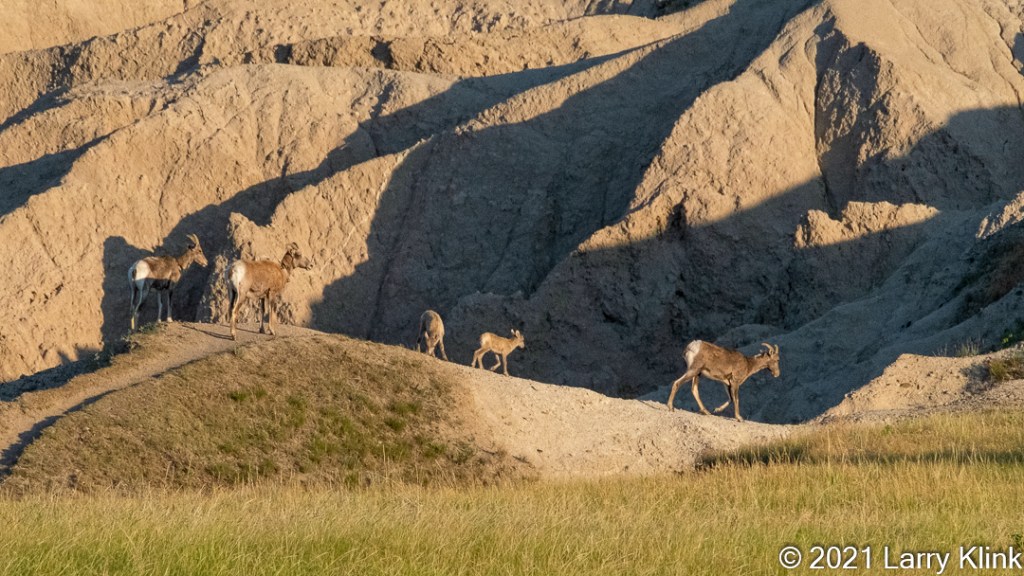
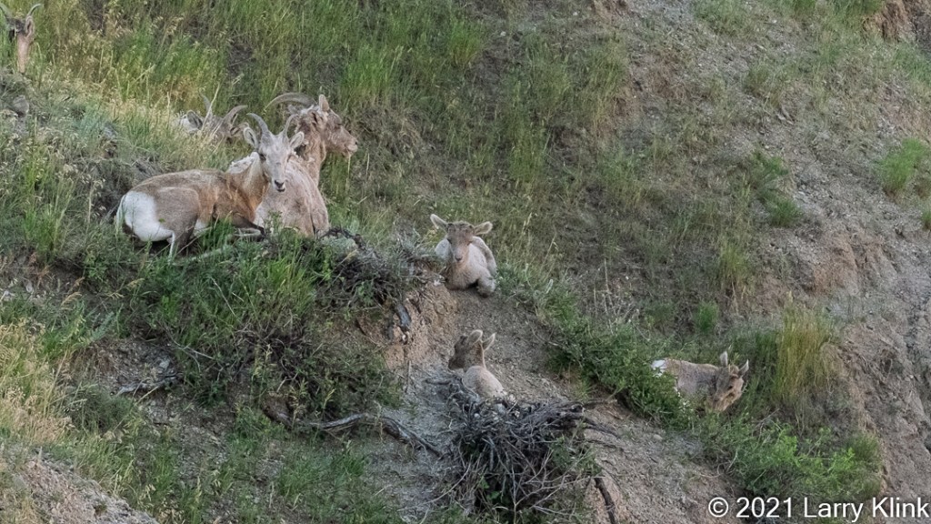
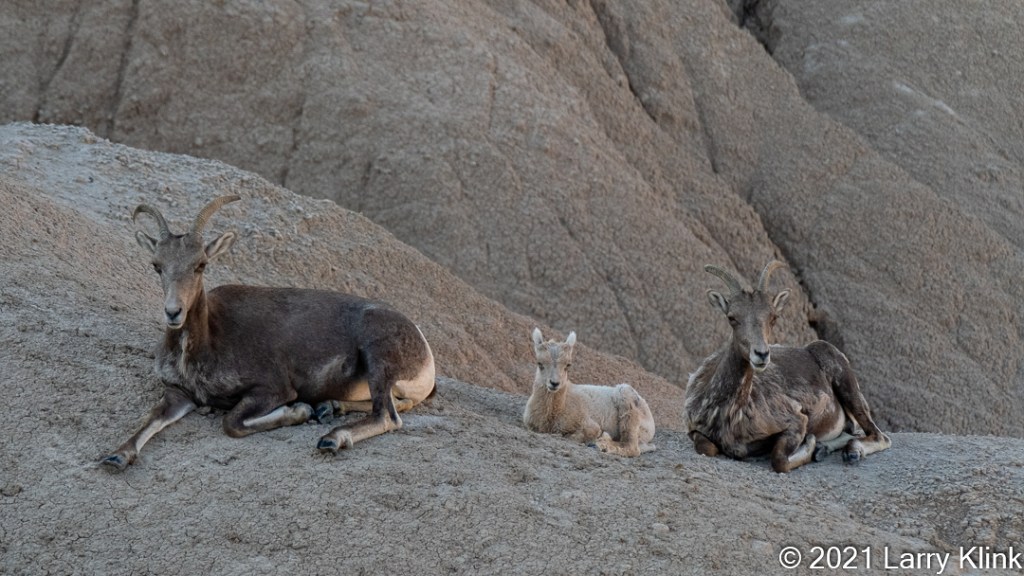
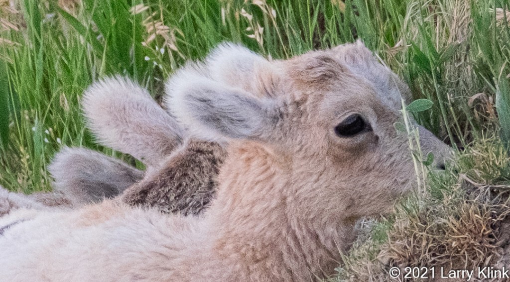
One of the interesting sites at Badlands National Park were the Bighorn sheep. It was especially fun to watch because they had babies.
Bighorn sheep are not native to Badlands National Park. Twenty-two were introduced in 1964 from the Pike’s Peak area in Colorado. The population is now estimated to be over 250. There are no natural predators to the Bighorn at Badlands National Park.
Please click on caption to see images at higher resolution!
If anyone would like a copy of almost any picture in my library, for educational or research use, please contact me and I will happily share a digital copy with you.
Please visit my website, www.earthwatcher.us to see my collection of landscapes and wildlife.
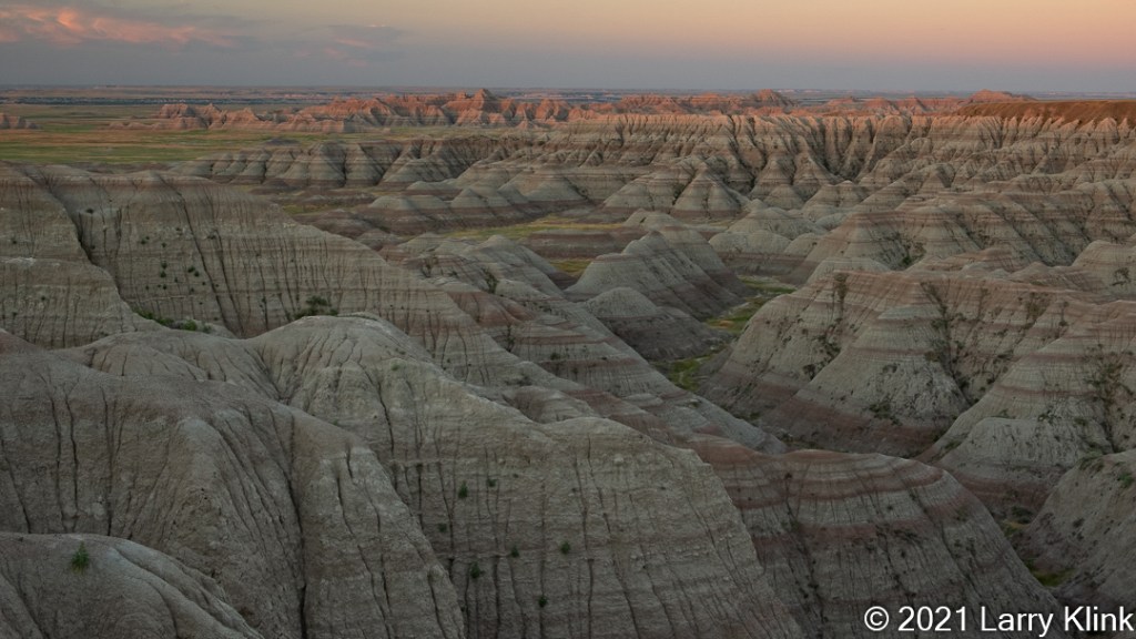
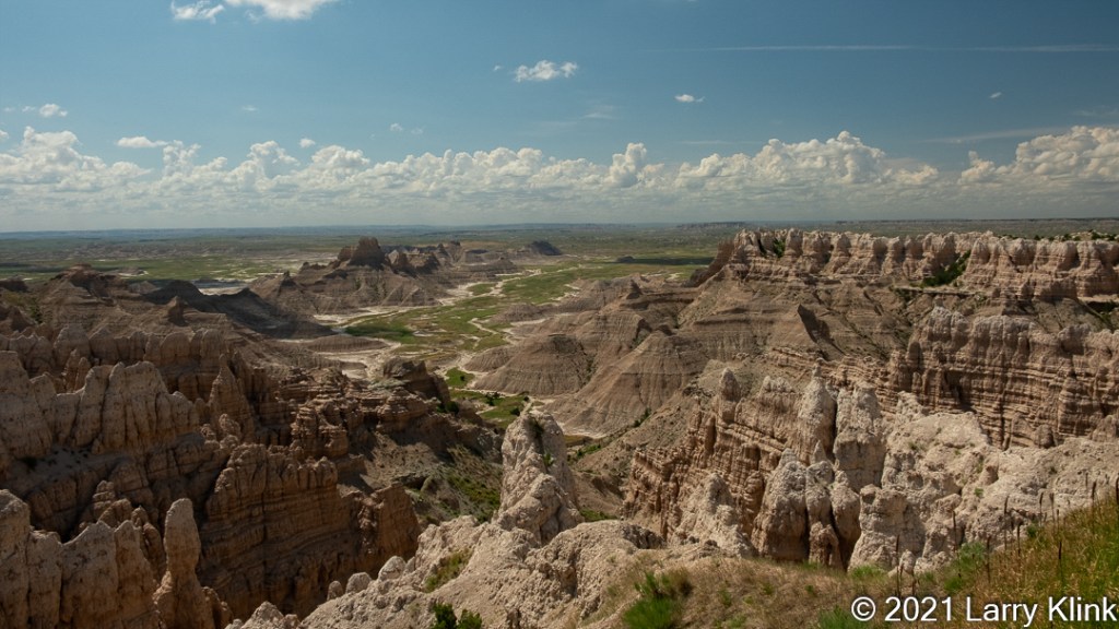
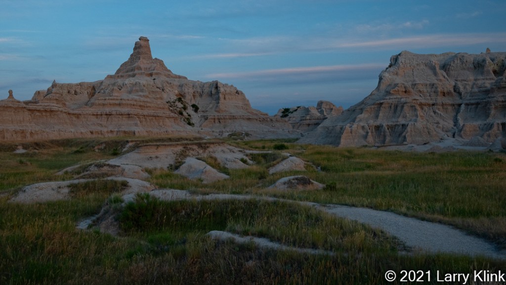
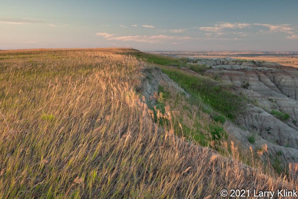
When you drive through Badlands National Park, on one side of the road is prairie grassland. The other side is a wide, highly eroded valley. You are riding on the edge, the dividing line. Both sides were intriguing. The prairie was green but transitioning to golden brown, flat to the horizon. The valley is flat and desolate occupied only by scrub except where water flows through. Where the prairie meets the valley, the transition zone consists of beautifully eroded sediment layered in gray and rose-colored bands. The rock is crumbly, almost like dried mud. It is the results of how nature sculpted these erosional features that make the park interesting and beautiful.
Please click on caption to see images at higher resolution!
If anyone would like a copy of almost any picture in my library, for educational or research use, please contact me and I will happily share a digital copy with you.
Please visit my website, www.earthwatcher.us to see my collection of landscapes and wildlife.
We just returned home from a very long road trip; a trip that took us from California to Maine and back. One of the places we visited was Devils Tower National Monument. I wanted to visit because it is an iconic feature and I hoped to capture a sunrise and night sky shots. Like most of our trip we were in big sky country where the skies are not cloudy all day. That was unfortunate because high clouds would have set the sky ablaze with color at sunrise and sunset. So, I did my best with that I had.
Devils Tower is a small park. The visitors center sits at the end of the only road, and it is a short ride. There is a trail around the monument from the visitor’s center, but it was closed for construction.
Devils Tower is not a solid wall cliff face. It is a beautiful example of columnar joining; something that is typical of volcanic magma that has cooled slowly. In the case of Devils Tower, geologists believe it is an intrusion; i.e. magma pushed up and intruded between other rock. It cooled underground and formed the beautiful columns that make up its rock face. At the bottom of the tower is a boulder field made up of broken pieces from the columns above.
As we explored, we found the dirt road to the Joyner Ridge Trailhead and followed it. There we took a short hike up a knoll and sat on a bench to watch the sun set. I can’t begin to describe the feeling of calm and spirituality I felt up there. I am always awed by the beauty of nature but this was different and more. I often find peace hiking on trails but, again, this was more. Many Native American tribal groups hold Devils Tower as a sacred place for prayer and communing with the spirits. It was a blessing to be there.
Please click on caption to see image at higher resolution.
If anyone would like a copy of almost any picture in my library, for educational or research use, please contact me and I will happily share a digital copy with you.
Please visit my website, www.earthwatcher.us to see my collection of landscapes and wildlife.
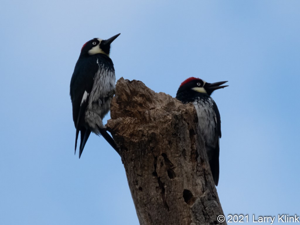
Acorn Woodpeckers are the most common woodpecker species that we see in the Sacramento, CA area. They are very active, industrious, and highly social birds. They live in family groups in a single nesting cavity, they manage a large acorn granary stored in holes they drill in dead trees, and they are very territorial.
One of the California Naturalists at Effie Yeaw Nature Center, wrote a short, interesting article about them. The article was published in “The Acorn” summer newsletter from Effie Yeaw Nature Center. (2021acornsummer.pdf (capitoltechsolutions.com)). It is a fascinating read sure to increase your appreciation of the interesting birds.
Please click on caption to see image at higher resolution.
If anyone would like a copy of almost any picture in my library, for educational or research use, please contact me and I will happily share a digital copy with you.
Please visit my website, www.earthwatcher.us to see my collection of landscapes and wildlife.
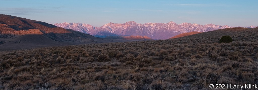
Sierra Nevada Mountains at Daybreak; Big Pine, Death Valley Road, Big Pine, CA; APR 2021
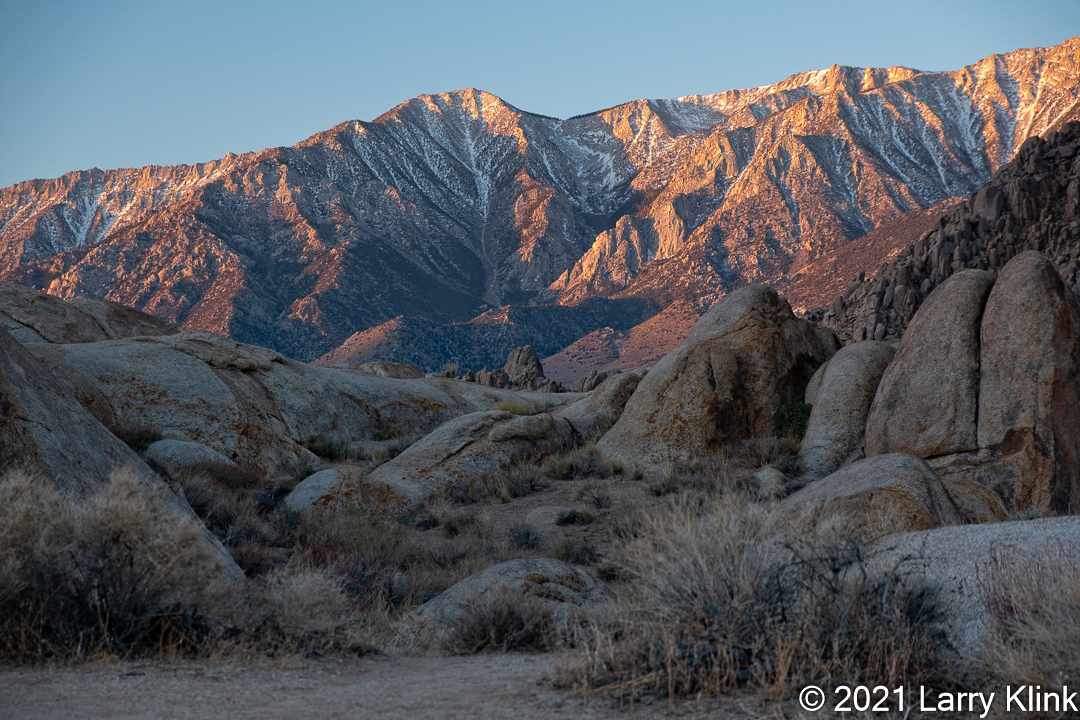
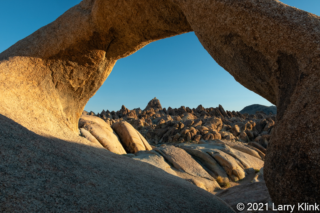
I’m sharing a few more pictures from our trip to the Eastern Sierra last April. Four of the images were taken at the Alabama Hills near Lone Pine, CA. (Alabama Hills National Scenic Area | Bureau of Land Management (blm.gov), @TheAlabamaHillsNationalScenicArea). The other is from Big Pine Death Valley Road.
I hope to go back to the Alabama Hills this fall because there are so many wonderful small vignettes to capture, and I am curious to see it at sunset as well as when some monsoons rains are falling over the Sierra as the backdrop.
Please click on image to see image at higher resolution.
First Light on the Sierra; Alabama Hills, Lone Pine, CA; APR 2021Mobius Arch from the Backside; Alabama Hills, Lone Pine, CA; APR 2021Sunrise on Mt Whitney; Alabama Hills, Lone Pine, CA; APR 2021Lone Tree along a Desert Path; Alabama Hills, Lone Pine, CA; APR 2021
If anyone would like a copy of almost any picture in my library, for educational or research use, please contact me and I will happily share a digital copy with you.
Please visit my website, www.earthwatcher.us to see my collection of landscapes and wildlife.