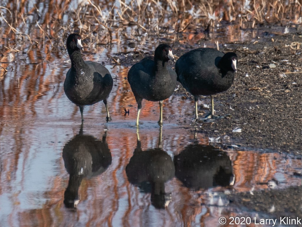
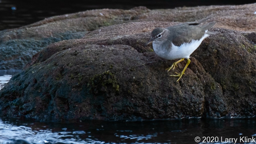
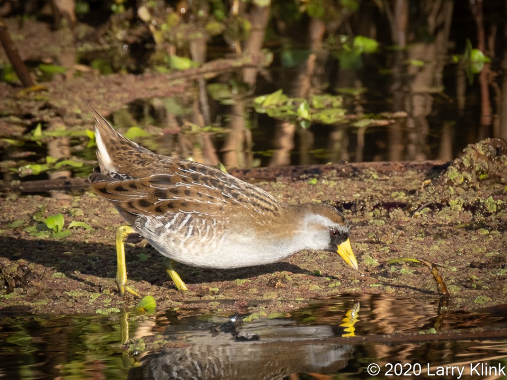
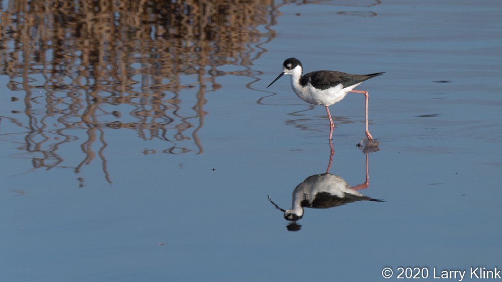
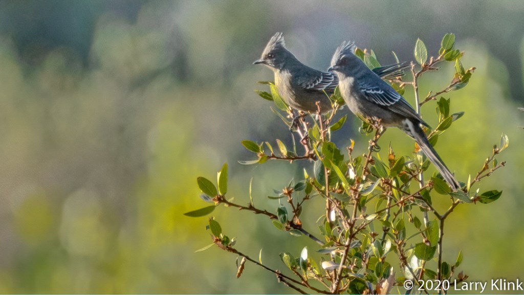
Today I am sharing some birds we find foraging around the shore of our lakes, ponds, rivers, and sloughs. Some of these birds can be found here in the Sacramento region year-round but most are much more prevalent from late autumn to early spring.
Please click on caption to see image at higher resolution.
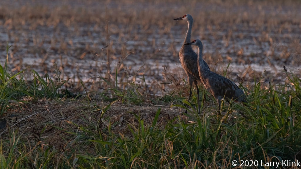
Last week we made the first of our pilgrimages to a spot where Sandhill Cranes winter over. It is still early in the migration and there seemed to be fewer there this year. I caught these images just as the last rays of the sun were setting over Mt Diablo.
Please click on the caption to see image at higher resolution.
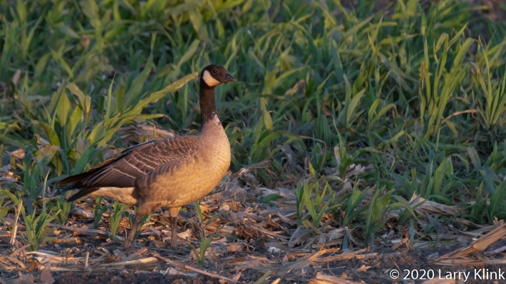
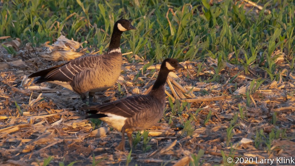
Living along the Pacific Flyway provides a treat; many birds pass through or winter over around here. Our most well known and popular of the winter visitors is the Sandhill Crane. But, in this post, I am going to present another visitor, one less known, the Cackling Goose (Branta hutchinsii).
The Cackling Goose and the Canada Goose look nearly identical and they are related. Until recently they were considered 2 subspecies of a single species. The Cackling Goose is smaller and makes a distinctive cackle instead of the Canada Goose’s honk. One of the field marks I use to identify them is a white band at the base of the black neck; its not a perfect identifier but it is very good.
While the Canada Goose is ubiquitous year around, I have only seen the Cackling Geese, reliably, in a limited area and only in Late October and November. One birder told me that we get the Aleutian Subspecies; there are several other subspecies.
Please click on caption to see imaes at higher resolution.
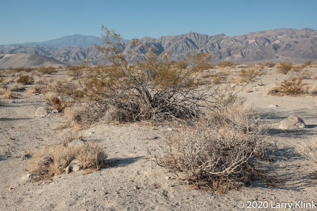
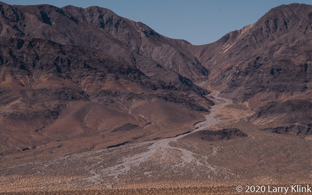
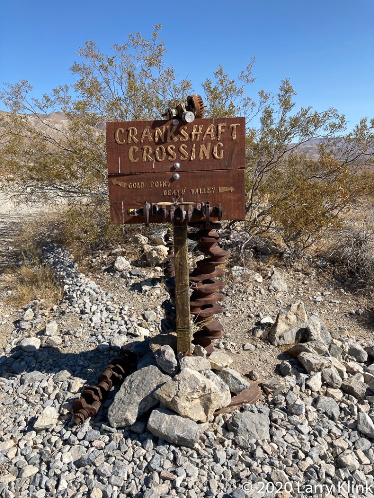
On our last trip to the Eastern Sierra, we explored Big Pine – Death Valley Road. Twenty-five miles from Big Pine, CA, the pavement ends, and you enter Death Valley National Park. The route took us through Eureaka Valley, over the Last Chance Mountains to Crankshaft Crossing where we made a right to continue on Death Valley Road. That led us to Ubehebe Road then to Scotty’s Castle Road and further to Stovepipe Wells. It was a fun trip through beautiful desert despite the tire shredding rocks and washboard grating on the road. If you ever take this route be careful. Have really good tires and plan your timing; there are many washes that cross the road. They were all in good repair when we took the trip in early autumn. But, they could be bad in other times of the year.
Please click on caption to see image at higher resolution.
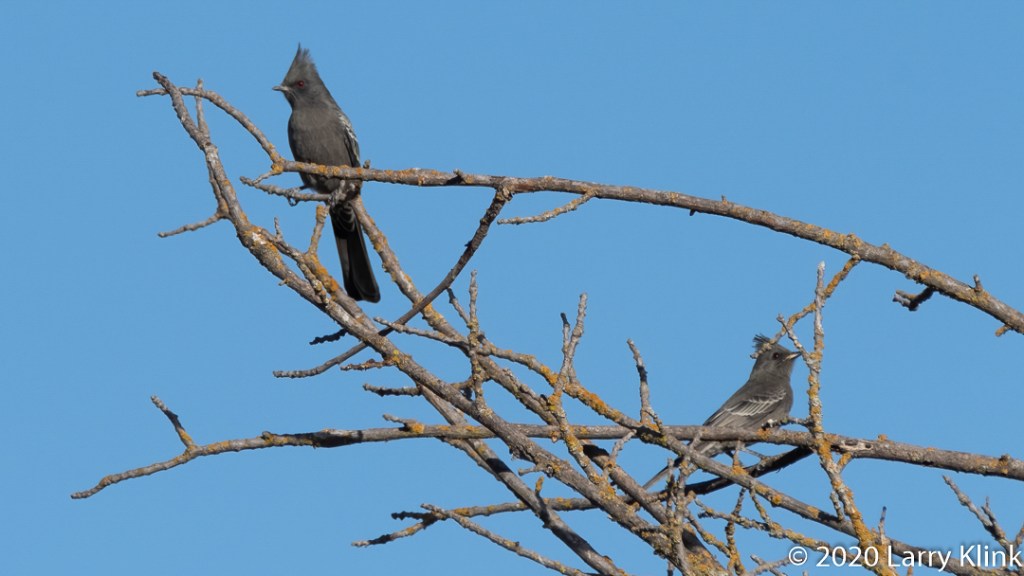
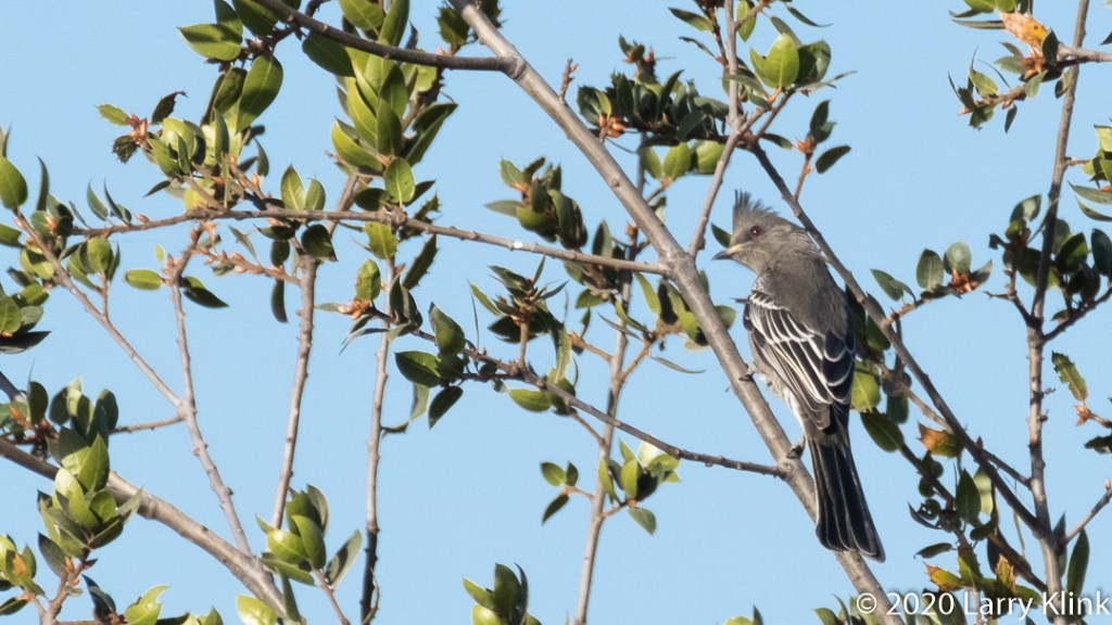
The Phainopepla (Phainopepla nitens), is a bird we see in the Sacramento area, but my experience is that it is not seen often. In fact, “Checklist of the Birds of the Sacramento Area” says they are hard to find in the summer but are a little bit more prevalent the rest of the year. Their range is generally the Southwestern US and Mexico as well as California’s Central Valley.
According to All About Birds from Cornell Labs, they are a silky flycatcher, not related to other North American Flycatchers. They eat insects and berries, especially the berry of the desert Mistletoe. Though they have their own call, they sometimes imitate the calls of other birds.
The name Phainopepla, comes from the Greek: Phain Pepla, meaning shining robe, likely referencing the shiny black feathers of the male. They have red eyes but I have noticed while photographing them the color varies to black and yellow depending upon the angle and strength of the light.
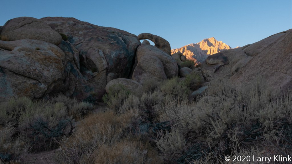
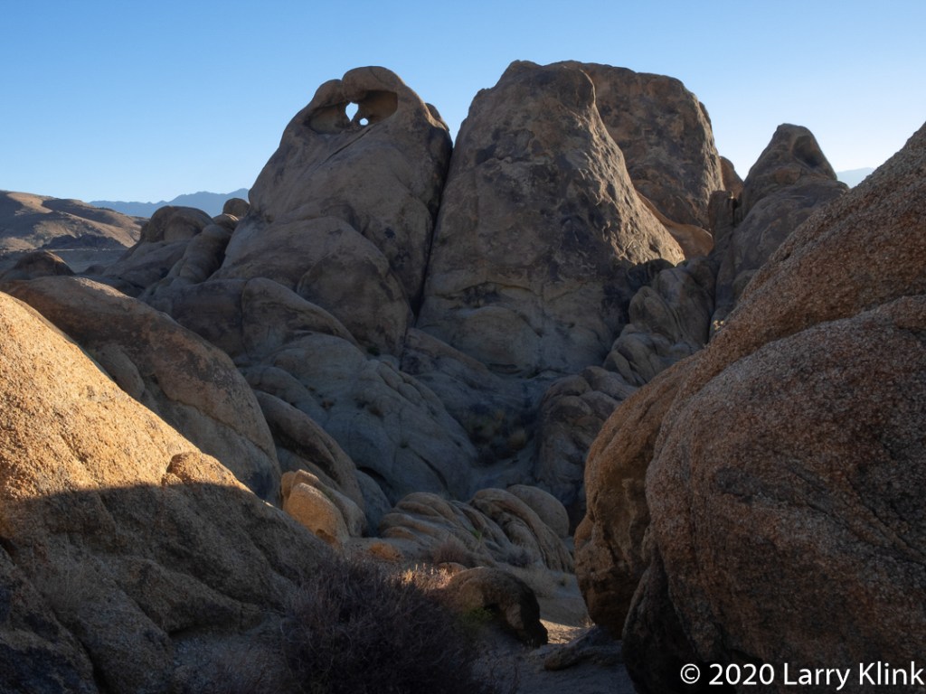
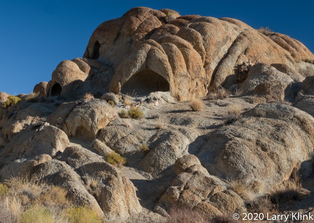
The Alabama Hill in Lone Pine, Ca, is a geologically unique rock field from the same period as but separate from the Sierra Nevada mountains. It is formed by large rock formations that have eroded into rounded shapes and arches. The trip on the Arches Loop Trail is magnificent. These hills are set below Mt Whitney and sunrises there are beautiful.
This rugged terrain has been used as a set for many movies, particularly westerns from the 1920’s through 1960’s. It was even used in a Star Trek film. As you drive or hike through the hills you can envision the bad guys “holed up” in the rocks shooting down on the good guys.
According to Wikipedia, the hills were named for the CSS Alabama, a Confederate warship. Confederate sympathizers named their mines in the area after the ship and the hills derived its name from the mines.
Please click on caption to see images at higher resolution.
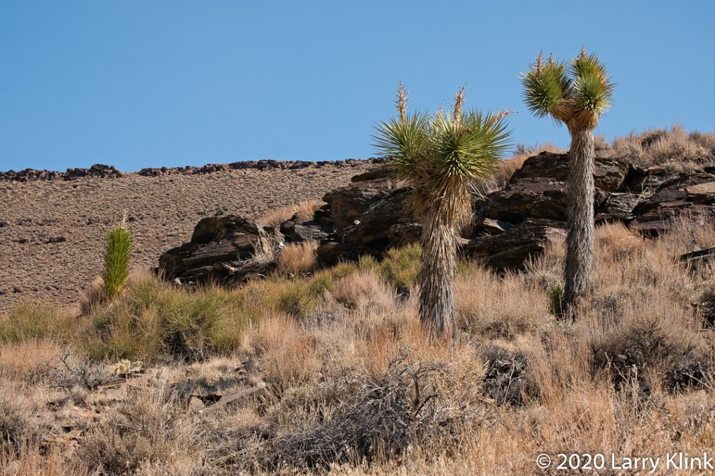
We spent some time exploring Big Pine – Death Valley Road. Along the way, we found some interesting things: A beautiful forest of Joshua Trees, and a wonderful White-tailed Antelope Squirrel. All of this set against the scenery of desert mountains. It was beautiful trip.
Be aware though, if you decide to explore this road, we have read that is one of the most dangerous roads in the country. We found the route to be in good shape but there are some things to consider. We found a lot of tire shredding rocks. There are numerous washes that cross the route so it could be flooded, or the road surface washed out. With photography stops, it took us 7 hours to get from Big Pine to Stovepipe Wells.
This post shares some images from the section between Big Pine, CA and the entrance to Death Valley National Park. I’ll share images from Eureka Valley and Death Valley in a future post.
Please click on caption to see image at higher resolution.
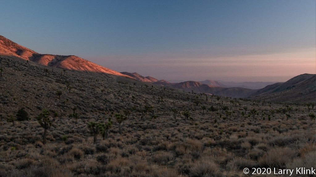
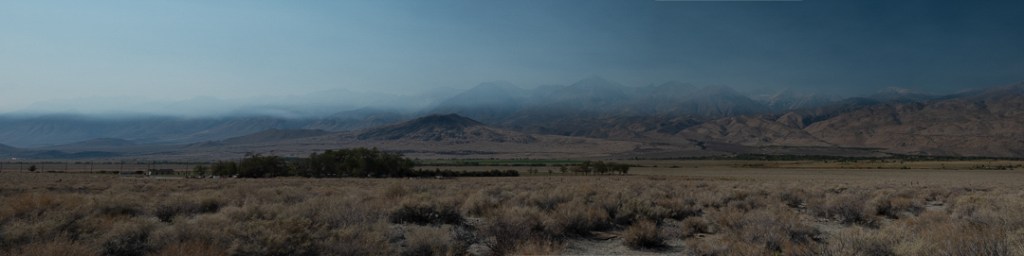
We made a trip to the Eastern California. We had planned the trip about 2 months earlier; before the wildfires. As we waited for the trip, we saw it threatened by the smoky conditions. We even pushed it back a week. As we traveled on Sunday, OCT 11 and even as we visited the Alabama Hills Monday morning, we enjoyed great skies and clear air. But, as we were leaving the Alabama Hills, we could see the smoke beginning to drift over the mountains. By Monday evening smoke from the Creek Fire had filled the mountains and the valleys. Returning to Mammoth Lakes on Monday, we often could not see the Inyo Mountains on our right; they rise tall and steeply just a few miles from the highway. Approaching Mammoth Lakes that evening, the surrounding forests were covered in a thick bank of smoke that looked like a blanket of fog in the late evening light. Tuesday morning the crescent moon and Venus were visible, but both were colored orange. Venus looked like a bright Mars.
We had planned several separate photo shoots, much of which we had to abandon. We salvaged Monday afternoon and Tuesday by travelling south into Death Valley. We left Wednesday cutting a day from our trip.
Please click on caption to see images at higher resolution.