If anyone would like a copy of almost any picture in my library, for educational or research use, please contact me and I will happily share a digital copy with you.
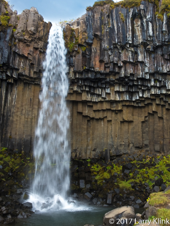
When I close my eyes and picture Iceland, I think of coastal plains lying between the ocean and tall cliff sides. At some places, the plains are grass covered, at other places they are filled with jagged black lava. The cliff sides are impressively tall and massive. They are green with vegetation and filled with outcrops of volcanic basalt. All along the cliff sides, waterfalls appear at frequent intervals. Free range sheep, in small groups, dot the hillsides. Oceanside beaches are black from the volcanic rock and sand.
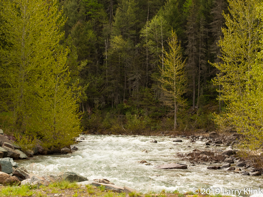
Glacier melt from the ice covered volcanic mountains creates many, many small streams. These streams drop in long thin ribbons of white from the cliffside. Where they hit the plain, they cut small streams that meander their way to the oceans. In September, the streams flow through gullies in their rocky beds. But, I am told, that in the spring the beds are full of raging water. The streams travel short distances so they don’t have time to merge into large rivers. Despite their size, the fall from glacier to ocean gives them a swift current.
The plains are used for ranching. A few ranchers have cattle but most raise sheep and horses. Icelandic wool products are sold throughout the country. Lamb is a staple; Icelandic meat soup is very good.
There are also many horses which are unique to Iceland. They are short, stalky beasts with long, shaggy mains and tails. There is little farming. In fact, we saw only one garden at a home behind a place where we stayed.
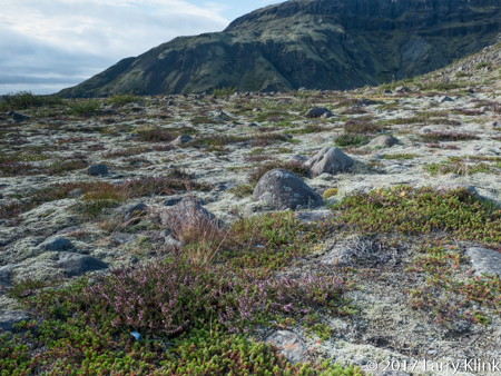
Iceland has a history of recent volcanic activity. So, the rocks are angular and jagged. They haven’t had time to weather into smoother surfaces. But, even in the lava fields, grasses and wildflowers grow between the rocks and gravel. Moss sometimes grows on the volcanic rock giving the lava fields a soft, velvety green color to contrast with its normal black, jagged features.
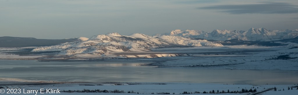
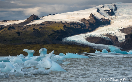
As you travel through Iceland, you get glimpses of the massive glaciers that cover many of the mountains. In a few spots, glacial tongues reach the valley floor. Where this occurs, you can see the blue icy edges of the glacier. At the edge, ice breaks loose and falls as icebergs into lagoons. In Jökulsárlón, the icebergs float down a short river and into the ocean where some flow back onto beach.
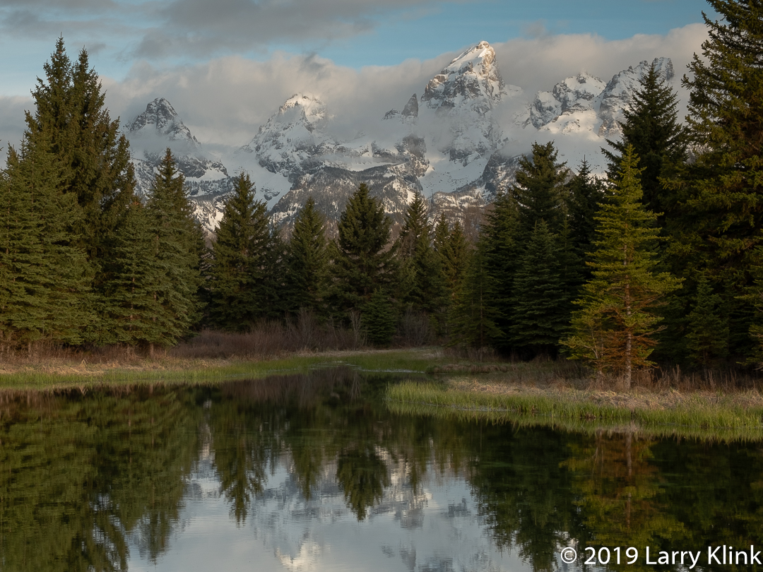
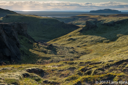
We got to spend precious few hours in the highlands (mountains). One visit took us across a rocky riverbed of gray-green volcanic rock into hills made of broken shards of shale. Shale is sedimentary rock meaning it formed under a calm lake or ocean. It is an anomaly in an otherwise volcanic landscape. A second trip took us to a high valley near one of the glaciers. The valley is reminiscent of those you might see in a medieval fantasy story. The path through the jagged rocks of the tall valley led uphill, next to a stream that cascades from the glacier. The atmosphere was cool and damp. The cliff side was covered with moss and wildflowers.
I’ll be publishing more images focused on different features. Iceland is a remarkably beautiful place. I look forward to visiting again.
Note: Click on caption to see images in a larger size.
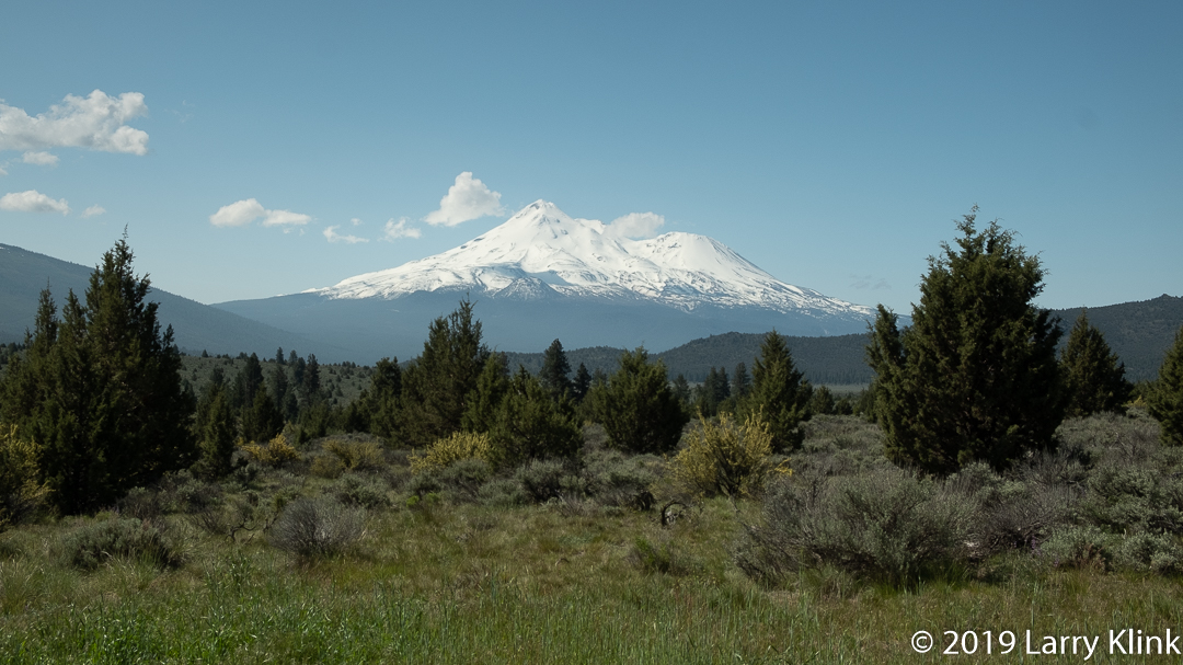
Mt Shasta, topping off at 14,167 feet, appears as a huge monolith rising out of the countryside as you travel through far North Central California. It is a stratovolcano; a large cone made of layers of different material ejected during its eruptions. Should Mt Shasta erupt, it will create severe natural as well as economic impact. According to Stephen L. Harris, in Fire Mountains of the West, during the last 10,000 years, Mt Shasta has erupted, on average, once every 600-800 years. But, its pace has accelerated to once every 200-300 years in recent centuries. Its last significant eruption was 200 years ago. There are no signs of imminent activity.
Mt Shasta, MAY 2015
Volcanoes can be quite disruptive. When we think of volcanoes, we see images of ash plumes, mudslides, lahars and other natural impacts. If you happen to be there when in erupts, it will change your life. But, their periods of activity represent only a very small fraction of their life. During periods of inactivity, the water from their snow melt brings moisture to the lands below. Additionally, water and wind erode the mountain side, spreading nourishing minerals to the land below. If you travel through Eastern Washington, Oregon and California, you see the benefits in places where the rich land has been put to use for agricultural purposes.
I hope you enjoy these images of Mt Shasta. As you do, pause to think about all we derive from this gentle giant who, only infrequently, explodes and creates havoc.