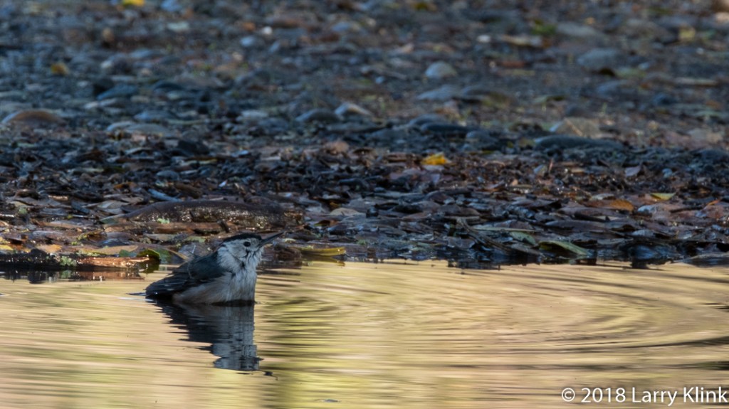
At last, the rainy season has arrived in northern California. The dry season runs from April through October so, when rain arrives, it is a wonderful thing to see. But humans aren’t the only ones that appreciate the new fallen rain. Some of the birds were happy to see puddles form so that they could perform their ablutions also!
Note: Please click on caption to see image in higher resolution.
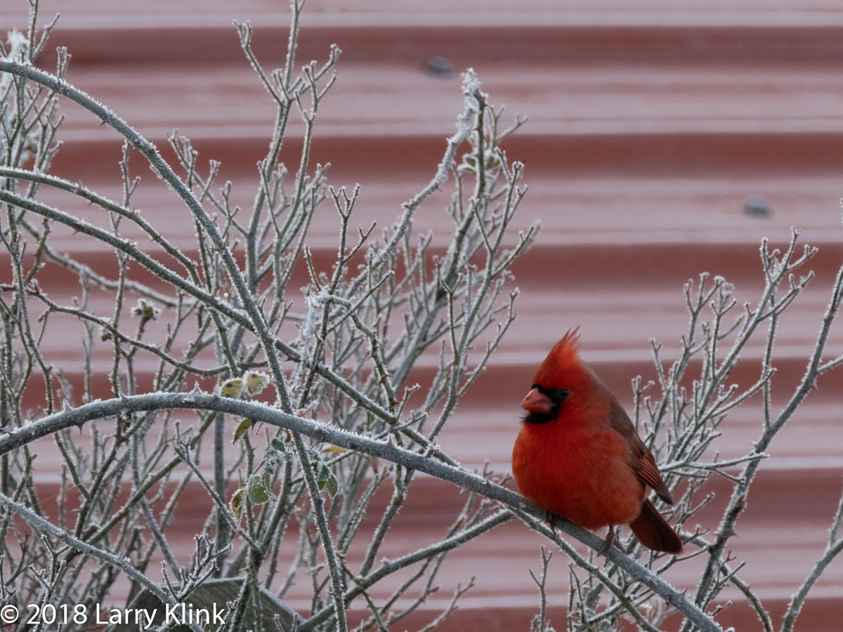
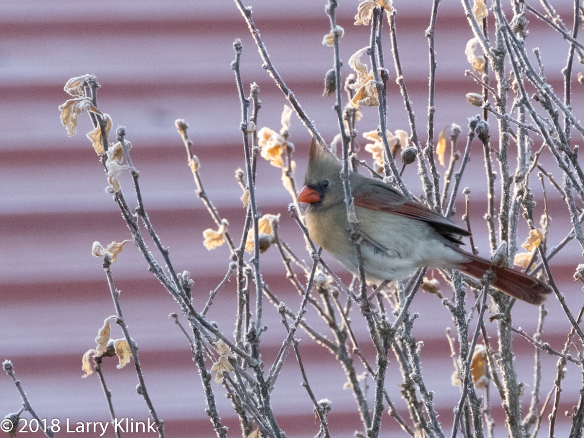
To be correct for the season, I should have had a cardinal on a bright green holly sprig draped with bright red berries and snow. However, I was in southeastern Oklahoma and had to settle for a frost covered crepe myrtle. But, the Northern Cardinal is a beautiful bird that looks lovely in almost any environment. I am happy to have gotten a few images to share with you. To my friends who celebrate Christmas, Hannukah, Diwali and Kwanza, may they brighten your holiday season. To those friends who don’t celebrate those holidays, may they brighten your week.
Note: Please click on caption to see these images at higher resolution.
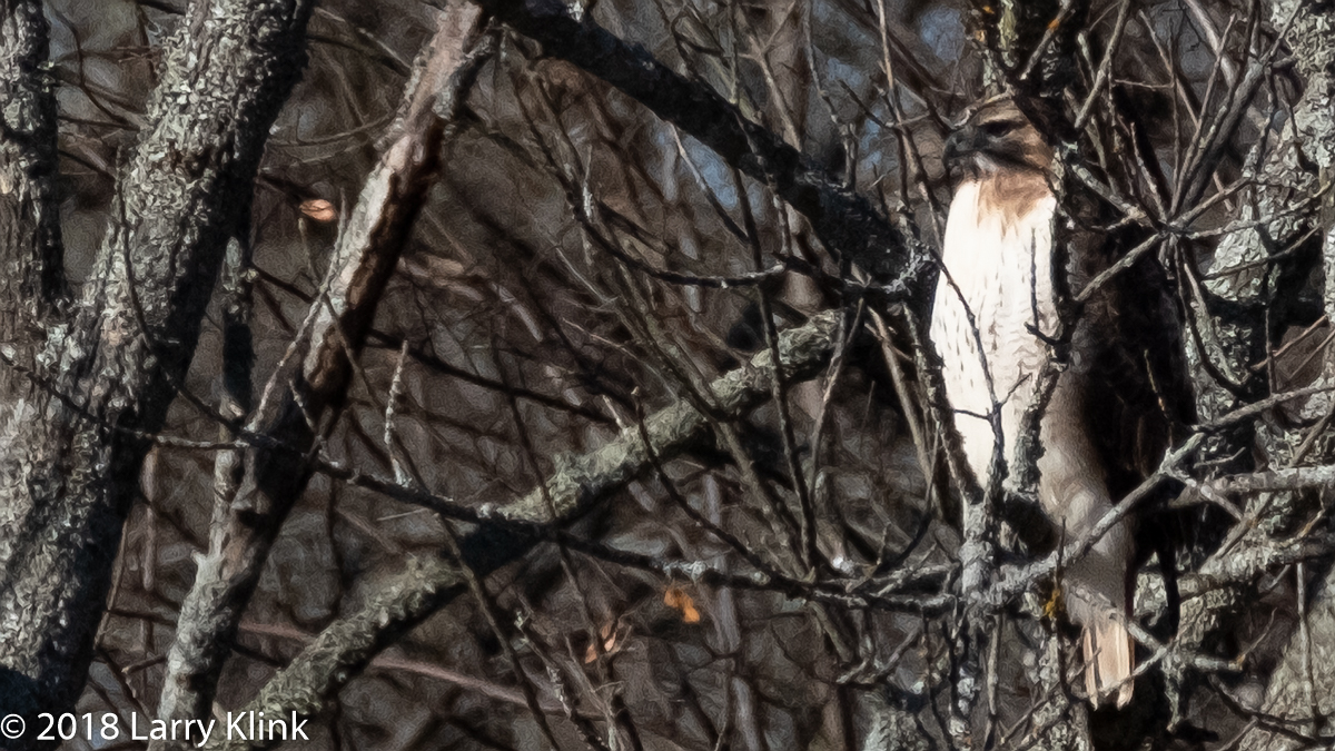
We made a visit to rural southeastern Oklahoma recently. While there, I was amazed at the number of red tailed hawks I saw. Much of the countryside was pastureland and I imagine it provided a lot of good food for the rodents and, in turn, the hawks. One day, I also saw a bald eagle in the grass, alongside the road.
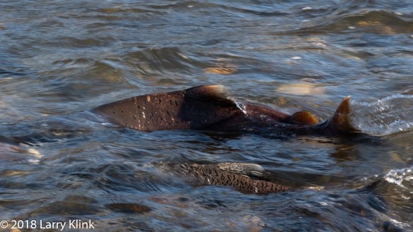
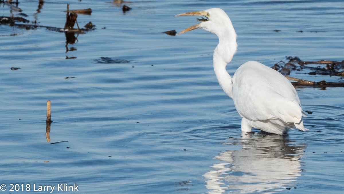
In November and December, the Chinook or King Salmon make their run into rivers along the Pacific Coast to spawn. Here, in Sacramento, they spawn in the American River. They lay their eggs in gravelly nests in shallow river beds. They need clean, cool, oxygenated, sediment-free fresh water for their eggs to develop. That means water that runs freely. Visiting Effie Yeaw Nature center yesterday, I got to watch some of the salmon preparing nests.They swam around in tight circles contorting their bodies and swishing their tail fins to clean any sediment from an area of river gravel. When they are done, the females will lay their eggs and the males will fertilize them. When finished spawning, both the males and females die. After the eggs hatch, those that survive mature for a few months then find their way to the ocean. If you walk along a river where salmon breed, look for an area where rocks are clean and shiny – it may be a salmon nest. They are usually about 6 feet by 2 feet.
I learned recently that prior to damming the American River,the salmon had a spawning ground of over 100 miles in the main river and tributaries. After the damming, it was reduced to 8 miles. To compensate, there is a fish hatchery just downstream from the Nimbus Dam. They open the fish ladders in November and December to capture salmon and spawn them. When the eggs hatch and grow to about 40 salmon per pound, they are released. They tag these salmon in some way and have tracked a 5 in 1000 success rate in salmon returning to breed. After the salmon run, they catch and spawn steelhead. The steelhead naturally come upstream to dine on salmon eggs.
In California, allocation of water is a contentious issue.Farmers have been promised water for irrigation and have seen those promises go unfulfilled, especially in years of drought. One of the oft sited points of contention is the amount of water required to support fisheries. As I pointed out above, the salmon need clear, cool, fresh water for their eggs to develop.Water that is kept in dams gets warmer and of course the outflow into the river is smaller. In order to protect the salmon fisheries, not just for human consumption, but also to keep the food chain enabled, some of the water needs to keep flowing from the dams. Many people rely on the fishing industry for their livelihood; not just for recreation. There are many other factors to consider. But, for this portion of the discussion, we must ask ourselves if the lettuce, almonds or beef are more important than the salmon to our diet because this is one of the compromises that need to be worked out.
Note: Click on caption to see image in higher resolution
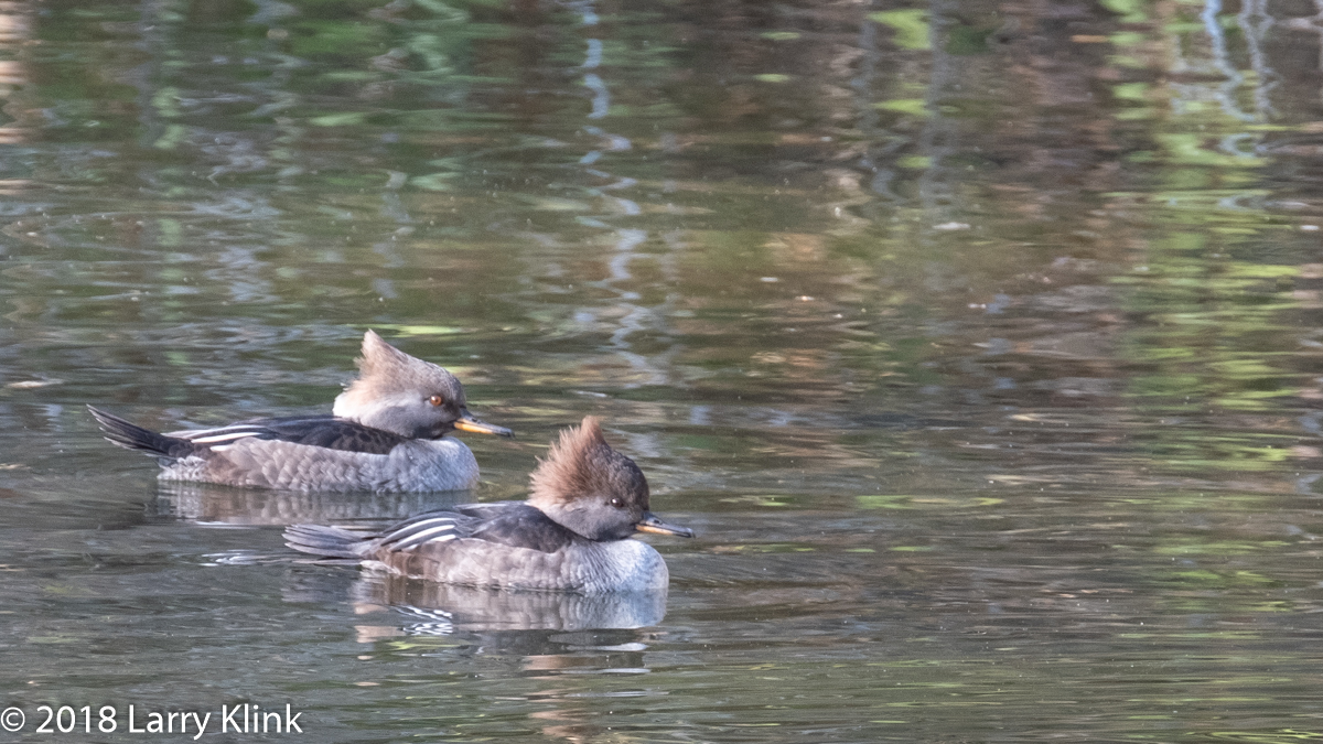
I regularly take long walks at different sections of the American River Parkway between Folsom and Fair Oaks. At one spot, along Lake Notomas, there is a small pond tucked back but alongside the bike trail. I never know what I am going to find. Last week, I was treated to what is a rare site to me – some hooded mergansers. Their cousins, the common mergansers, stick around all year. I often see belted kingfishers and acorn woodpeckers in that area also.
Acorn Woodpeckers are ubiquitous in this area. For those of you who aren’t familiar with them, their behavior is different from most other woodpeckers. They find acorns and pound them into holes in dead trees. When they can’t find a hole, they make one. Later, they come back and eat them – if the squirrels and other wildlife don’t get them first.
Regards,
Larry
Please click on caption to see image at higher resolution
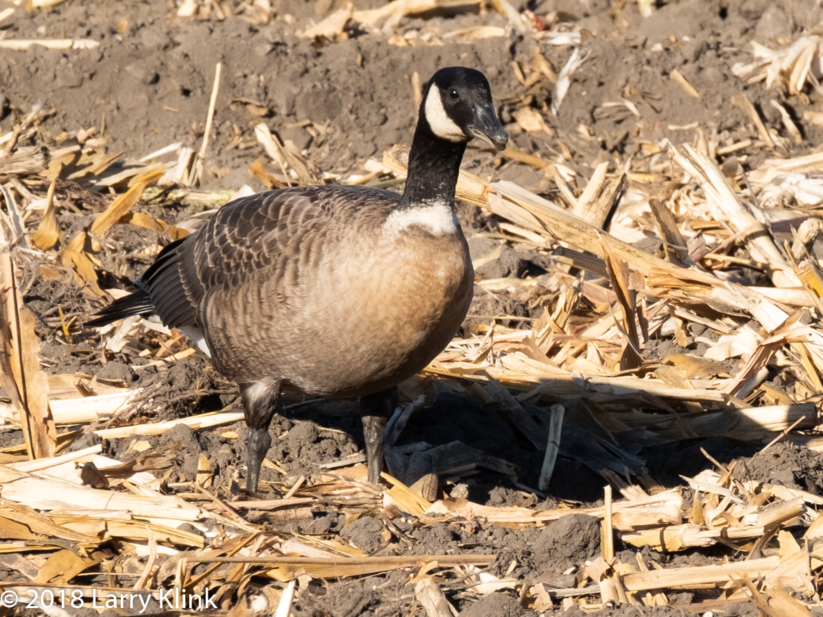
A couple of weeks ago, I went to photograph sandhill cranes. While there, I saw what I thought was Canada Geese. They seemed a bit unusual though, they were darker in color and instead of a handful, there were hundreds. I took a few images and thought little more about them. I stopped to talk to a person that led a tour I once took. I mentioned the geese. He told me they were not Canada Geese, they were Cackling Geese. I knew that several years ago, the powers that classify birds, split Canada Geese into 2 separate species: Canada and Cackling. All I ever knew was that the cackling geese were smaller. This person told me that there were other indicators: most have a white ring at the base of their dark neck and their call is more of a cackle than the honk of the Canada Goose; thus their name. So, it was a great experience. I learned something that will help me in the future. By the way, this was the Aleutian subspecies migrating to California’s central Valley from Alaska. They’ll start their trip back in January.
Please click on caption to see higher resolution image.
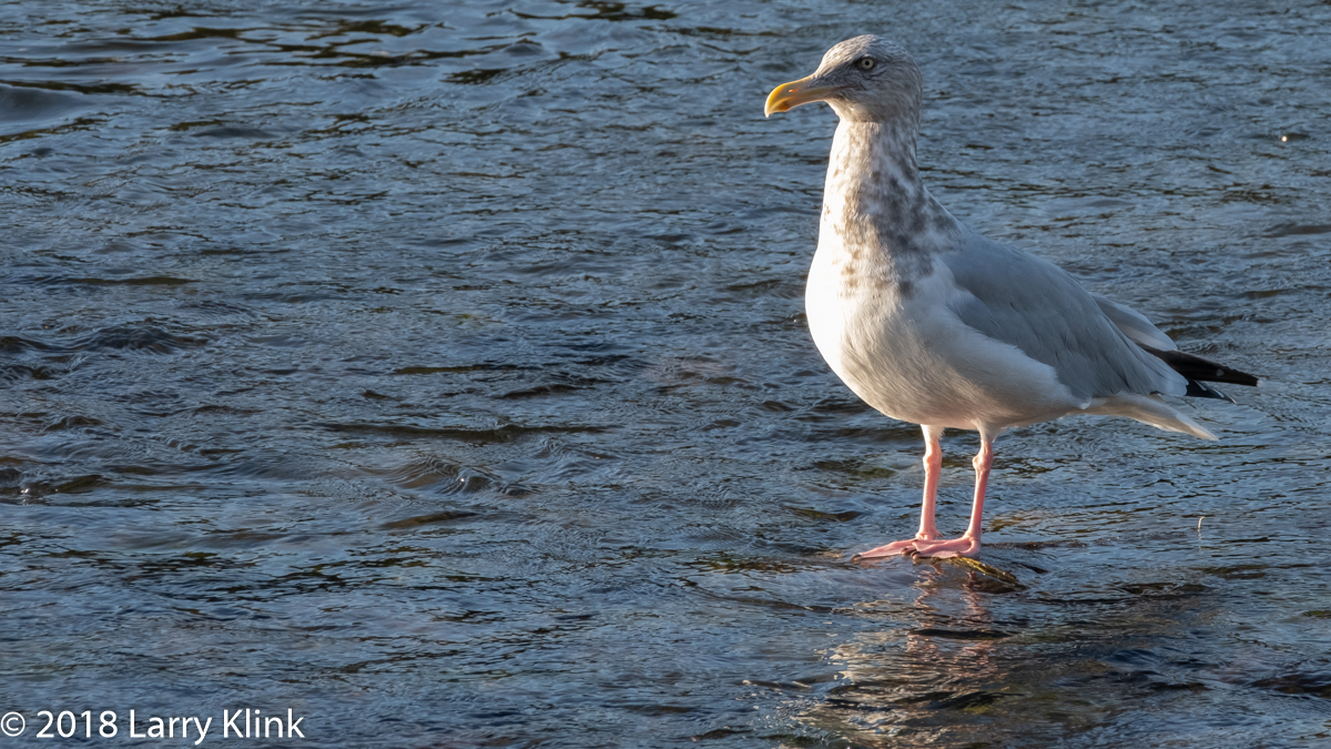
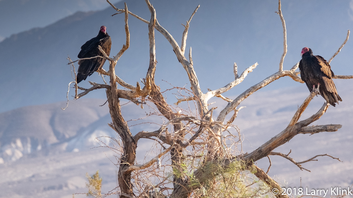
In November and December, the chinook or king salmon migrate from the ocean into the American River. The salmon breed and die. So, along with the salmon, the population of gulls and Turkey Vultures rise greatly. I assumed that what we see are California Gulls. After all, a gull is a gull. What I learned is we also get Herring Gulls. Both are white with a gray mantle, back and wing feathers. The California Gull is a noticeably darker gray, the Herring Gull is medium gray. The California Gull has yellow legs, dark eyes and a black spot on his bill; sometimes there is both a black and red spot. The Herring Gull has pink legs, yellow eyes and a red spot on his bill. Some of those colors change with the winter molt. I understand we also get the ring billed gull but I haven’t seen one.
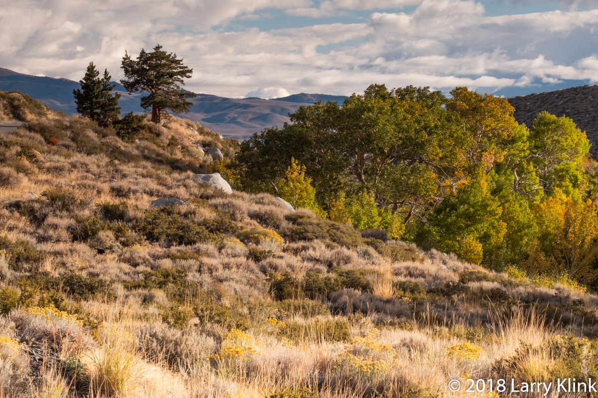
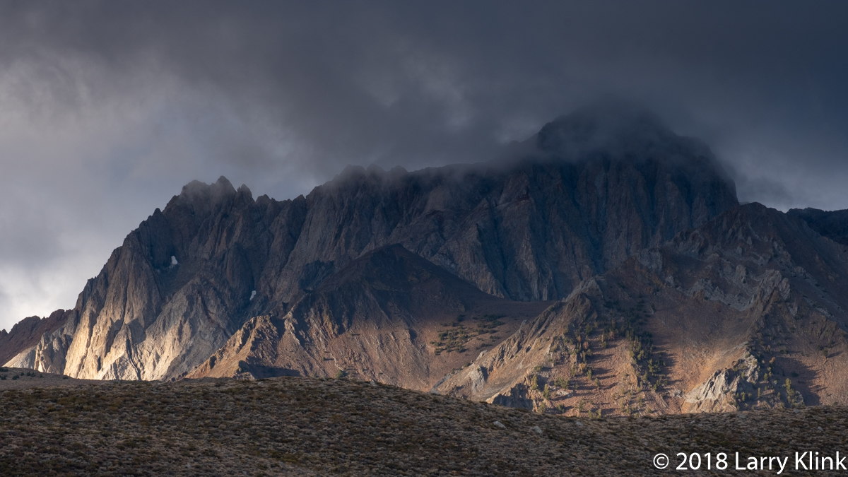
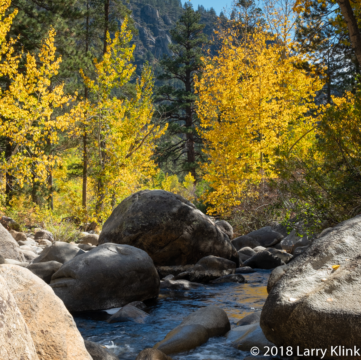
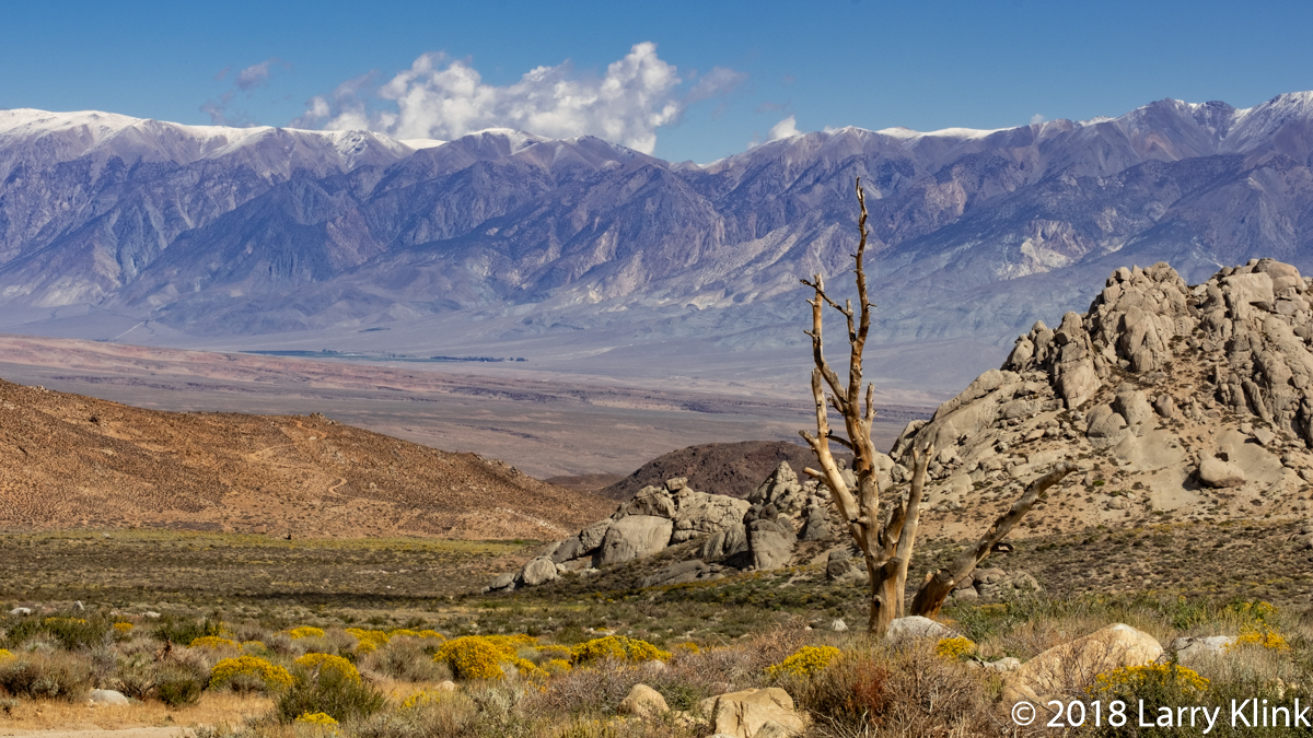
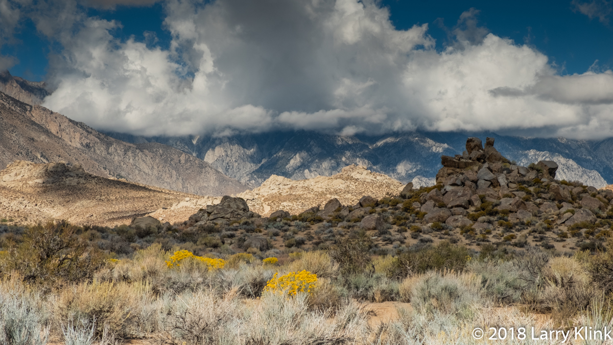
A few weeks ago, we took a trip to the eastern side of the Sierra Nevada, along route 395 from the junction of Rt 89 to Bishop, CA. Generally, we wanted to enjoy the autumn foliage. But we also wanted to explore Buttermilk County, the area along Buttermilk Road near Bishop. We did all of that and managed to include a drive into McGee Creek Canyon. The rabbitbrush was in bloom. Aspens and other trees were displaying the finest golds and oranges. It was a wonderful trip into the mountains.
Note: Please click on see images at higher resolution.
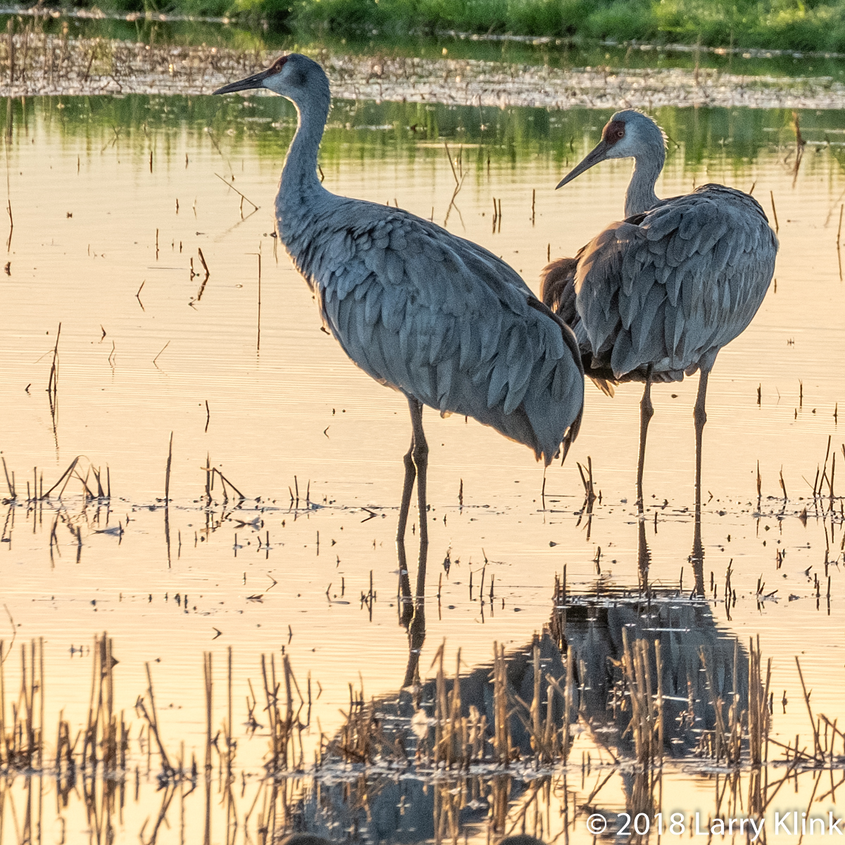
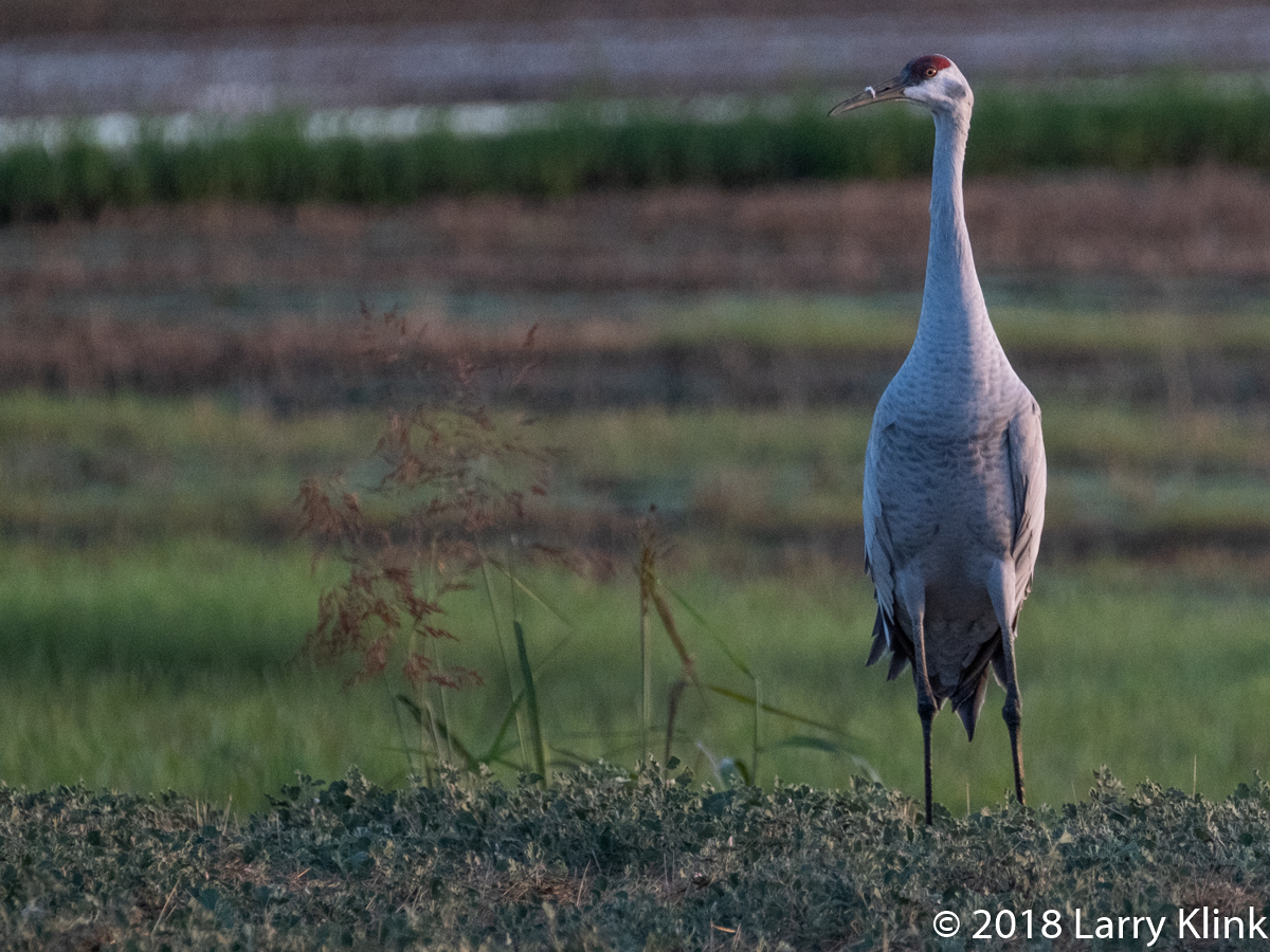
Sandhill Cranes populate much of the North America. But here, around Sacramento, we live along the Pacific Flyway; one of the primary migratory paths for birds heading to their wintering spot. One of the treats is that we attract large numbers of Sandhill Cranes who spend their nights in flooded rice fields and their days foraging in fields of cut grasses and grains.
Note: Please click on caption to see images at higher resolution.
Here is a few shots of some wildlife we saw travelling through various places. The locations are listed with each image.
We hadn’t seen any bears in the wild for several years. Then, on one trip, we saw 2. Unfortunately, the one that got away, was a cinnamon colored one. Maybe someday I’ll be able to photograph one of those.
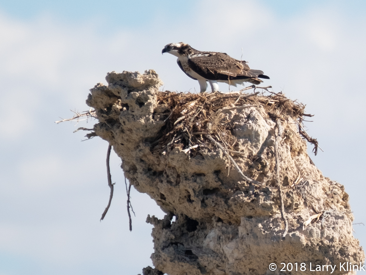
The tufa in Mono Lake are beautiful themselves but we got a rare treat – an osprey on its nest on top of a tufa.
Note: Click on caption to see image at higher resolution.
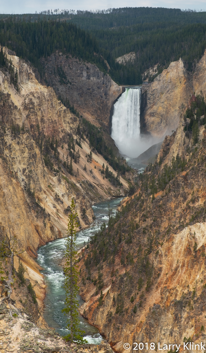
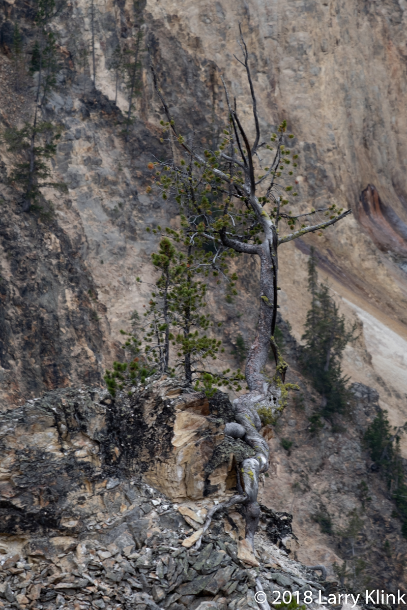
The Grand Canyon of the Yellowstone is another one of Yellowstone National Park’s iconic features. The steep, rugged canyon is cut through volcanic rocks that are colored by deposits of iron. It is being cut by the Yellowstone river which, in other parts of the park, seem calm and serene. But, in the canyon, it is a raging torrent. It tumbles down over Upper Yellowstone Falls (109’) then, after a short distance, tumbles over Lower Yellowstone Falls (308’). After the falls, the river flows its way alongside fumaroles and over cascades as it winds its way through the canyon.
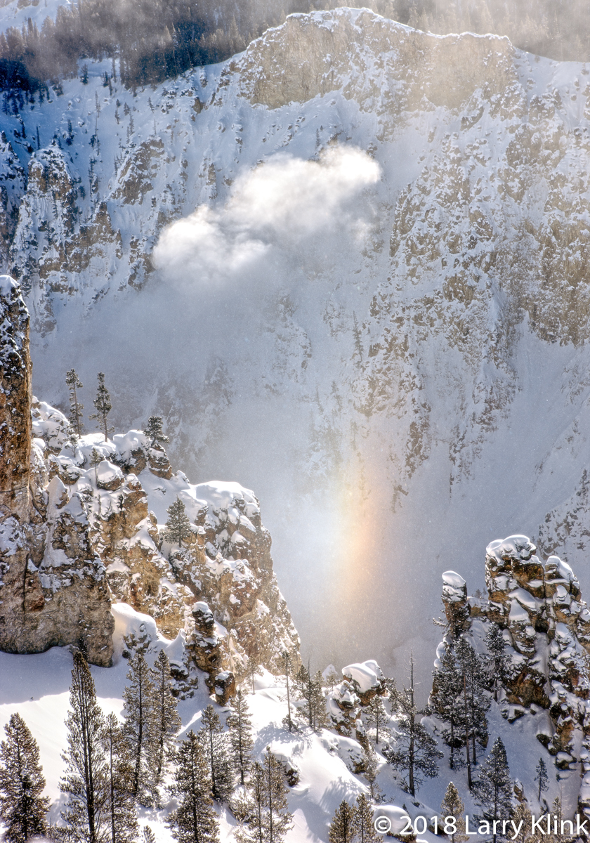
Most of these images are from a recent trip. But I decided to include 3 from previous trips to give you some other perspectives of the canyon. They are Bottom of Lower Yellowstone Falls with rainbow like color, The Beam, a unique winter phenomenon and Lower Yellowstone Falls in Winter by the Light of the Full Moon.
Regards,
Larry
Note: Click on caption to see image at higher resolution