If anyone would like a copy of almost any picture in my library, for educational or research use, please contact me and I will happily share a digital copy with you.
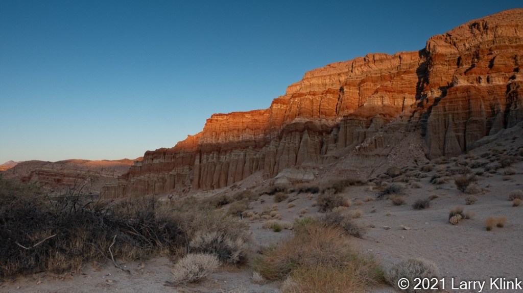
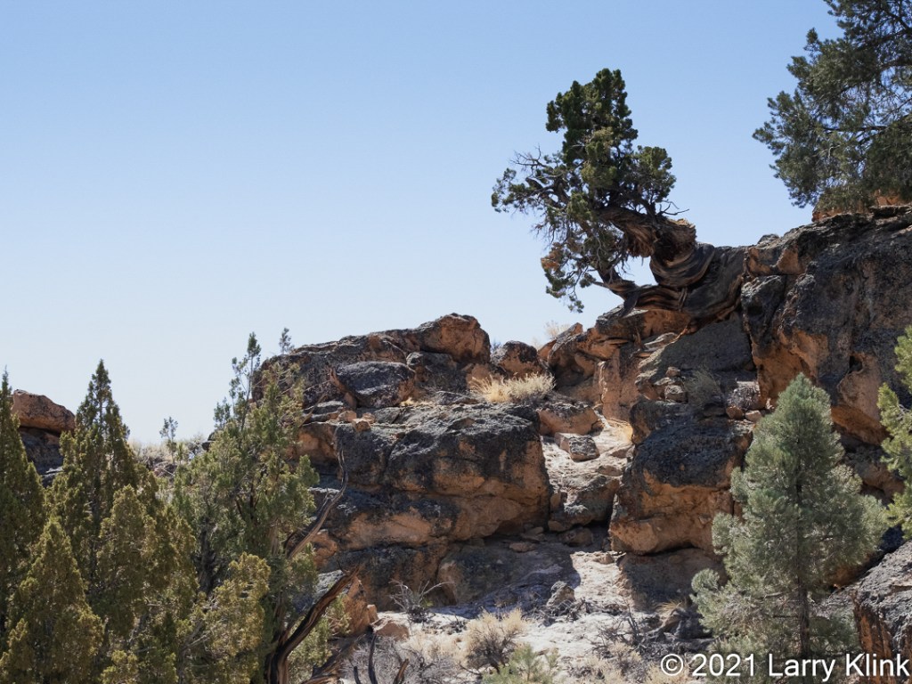
On our trip a few weeks ago, we made our first visit to Red Rock Canyon State Park on Rt 14 near Cantil, CA. We only spent one morning there so we limited ourselves to the Red Cliffs section of the park. We hiked out to the park boundary along the Red Cliffs trail during a cloudless sunrise. The temps were cool, the walk was easy and the red in the cliffs were true to their name.
Please click on caption to see image at higher resolution.
If anyone would like a copy of almost any picture in my library, for educational or research use, please contact me and I will happily share a digital copy with you.
Please visit my website, www.earthwatcher.us to see my collection of landscapes and wildlife.
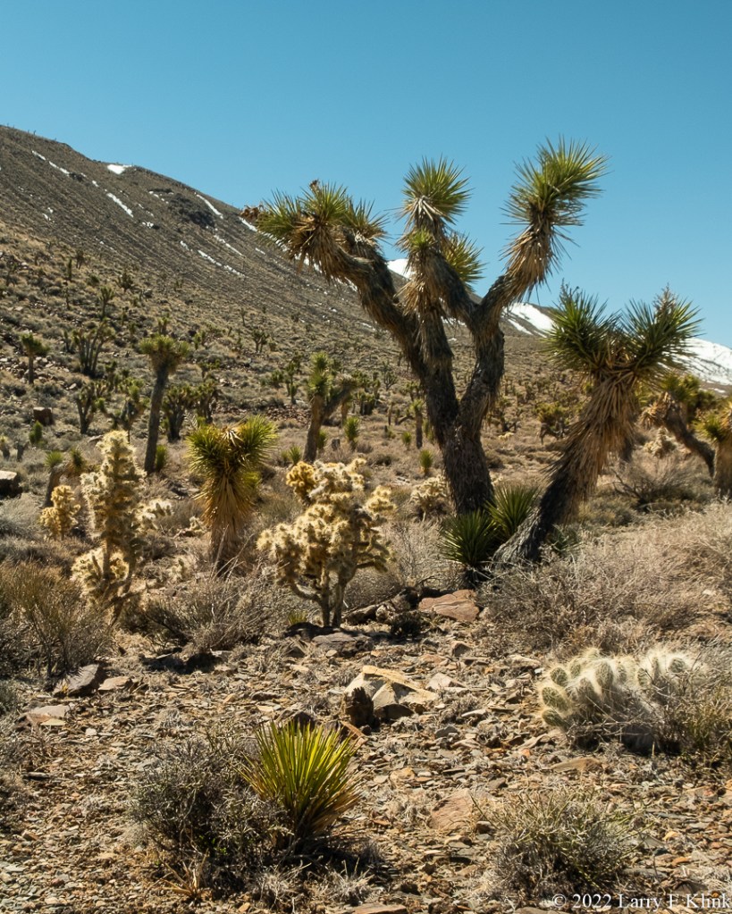
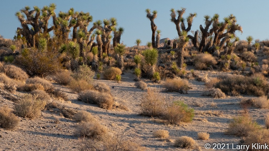
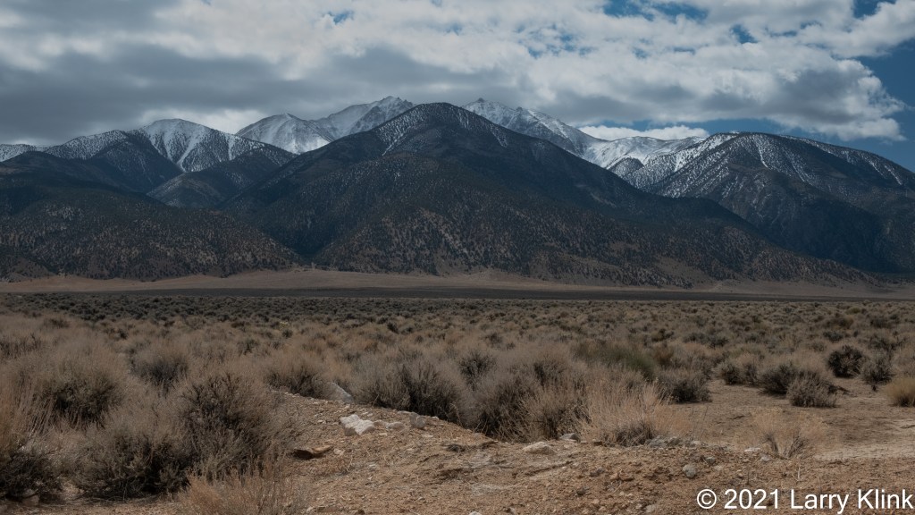
One of my favorite challenges is photographing the desert. We recently spent a few days enjoying the desert east of the Sierra Nevada mountains in California and Nevada. So, I got another opportunity to develop my approach. Most of these images were taken along Route 6, Route 266 and Route 120 in California and Route 264 in Nevada.
Please click on caption to see image at higher resolution.
If anyone would like a copy of almost any picture in my library, for educational or research use, please contact me and I will happily share a digital copy with you.
Please visit my website, www.earthwatcher.us to see my collection of landscapes and wildlife.
I’m cleaning up and
organizing my photo library. In that process, I uncovered a lot of photos that
I have never posted. Today, I am sharing a few from a cross country road trip
we took in 2017.
I hope you enjoy them.
Note: Please click on caption to see image at higher resolution.
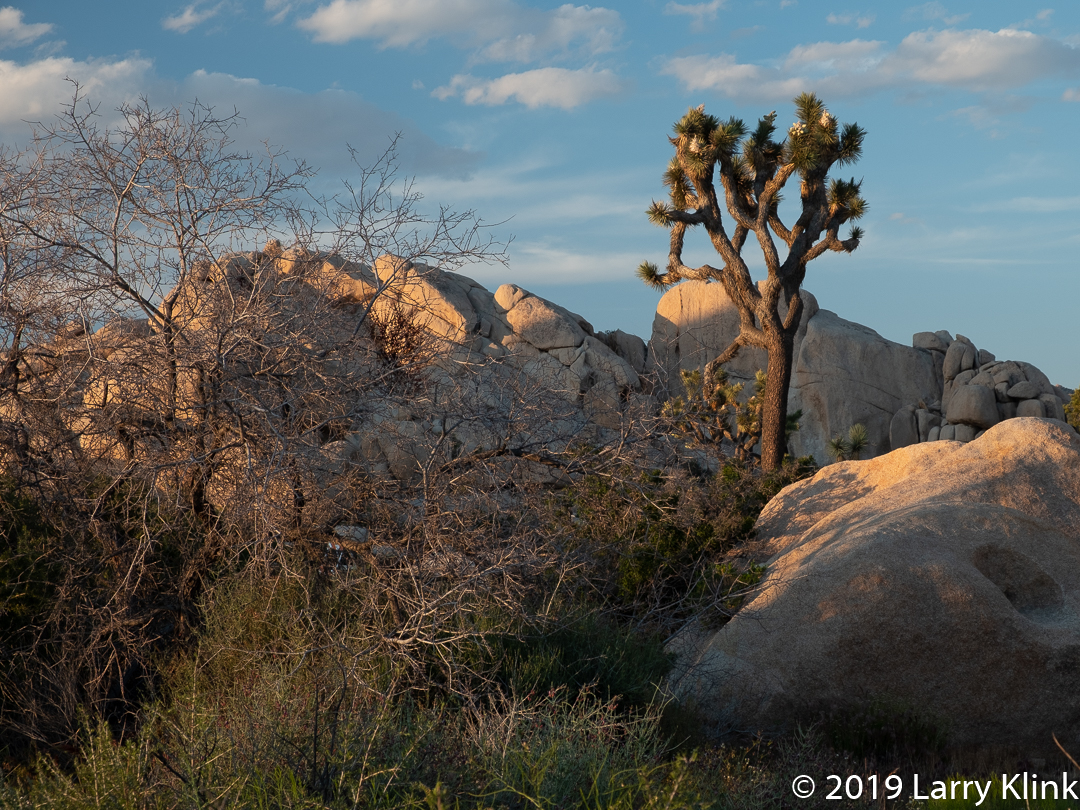
On a recent road trip, we spent a day at Joshua Tree National Park near
Twentynine Palms, CA. The trip was, in part, motivated by a chance to
photograph the Milky Way over the park. It was our first trip to Joshua Tree NP
and we really did not know what to expect other than it was a desert landscape
with Joshua Trees. It was indeed a desert landscape typical of the American
Southwest. It has beautiful eroding, rolling hills covered by talus – piles of
rocks eroded from the hillside. There were large, weathered boulders throughout
the park that people used for climbing. We learned that it is a very popular rock-climbing
location.
The desert was in bloom with ocotillo, cholla, desert senna,
Mojave mound cactus and many other plants. But, the signature plant of the park
is the Joshua Tree. The Joshua tree is a large tree like plant with hard spiky
leaves. Despite looking like both a tree and a cactus, it is neither. It is a
plant in the Yucca family (Yucca brevifolia). The oldest one in the park is
about 350 years old. Because it is not a tree, it doesn’t have the woody structure
to bear all of its weight, so, when branches get to big, they bend and fall to
the ground. We missed seeing them in bloom on this trip, but they were
developing their seed pods. I like them so much; I’d like to have one in my
backyard but they only grow in the Mojave Desert between 4,000 and 5,000 feet
in altitude.
Our night sky photo shoot was spectacular. The Milky Way
didn’t rise until after midnight. It was a pleasantly warm evening and we had
to scramble over some boulders, in the dark, to get to a ledge on another large
boulder. That location was picked because The Arch was directly in front of us
and our goal was to shoot the Milky Way over The Arch. I hadn’t done a night
sky shoot in a very long time, so it was great to knock the rust off my skills.
The only disappointment in the shoot was light pollution. When you look at the
Milky Way image, you’ll see the sky has a greenish cast along the horizon. That
cast is the light rom the Palm Springs and Indio areas of Southern California.
Indio is 25 miles from the park.
I want to give a shout out to Casey Kiernan of Joshua Tree Workshops for guiding us in a great night sky workshop and fun time.
Please click on caption to see image at higher resolution.
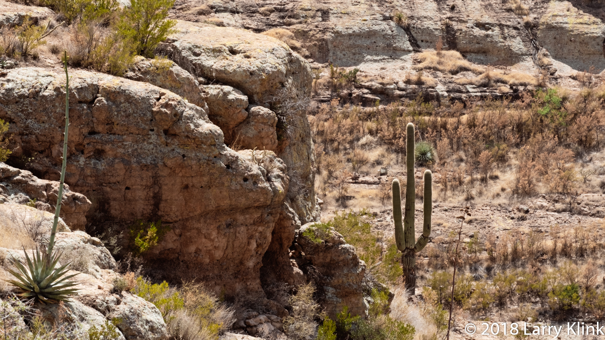
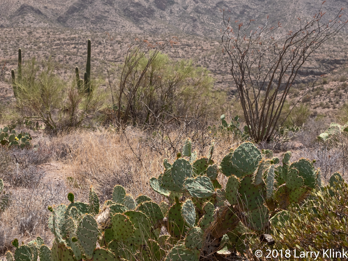
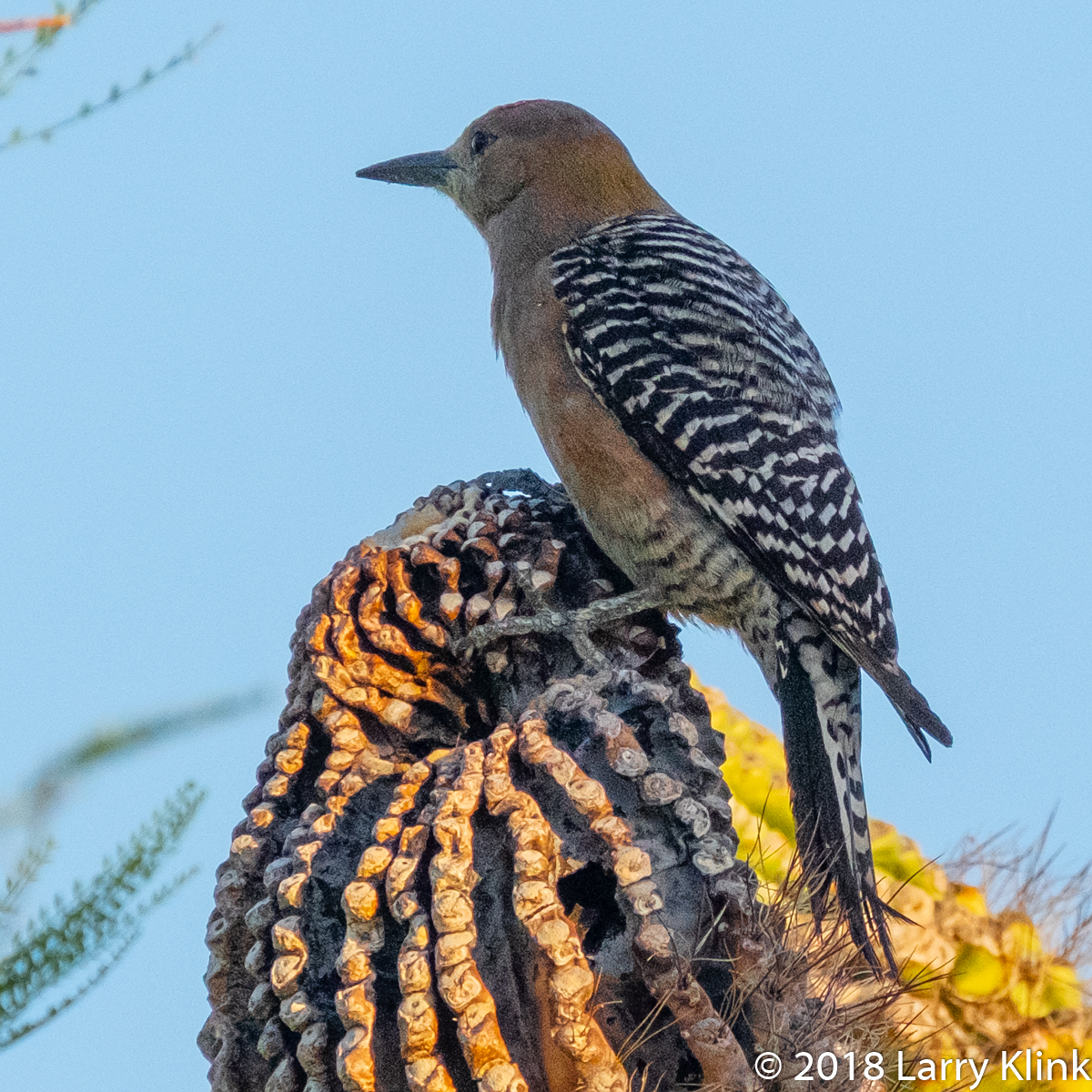
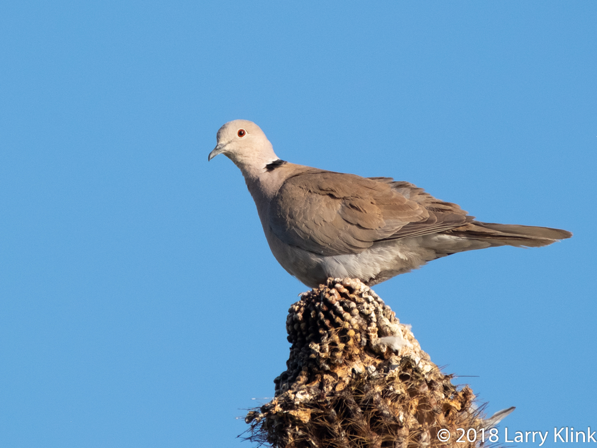
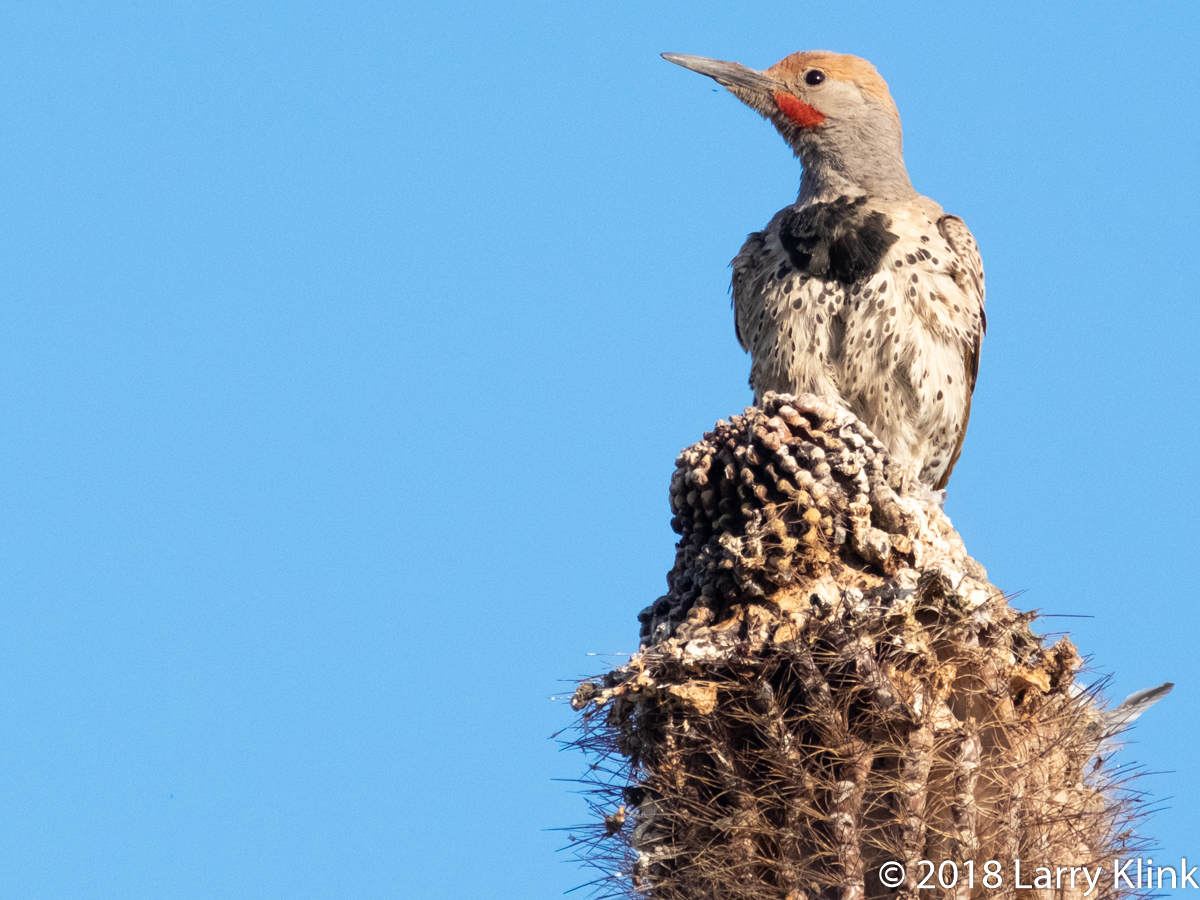
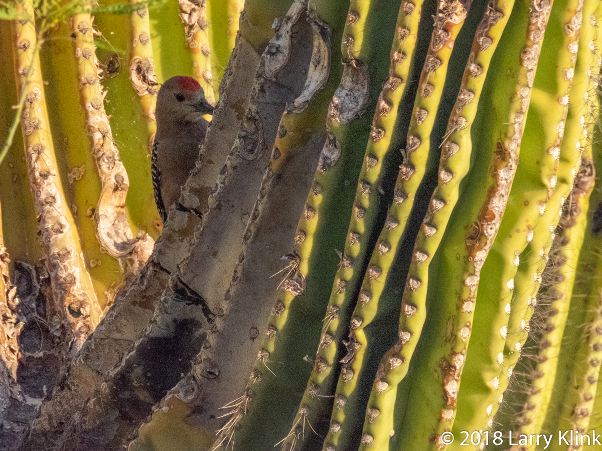
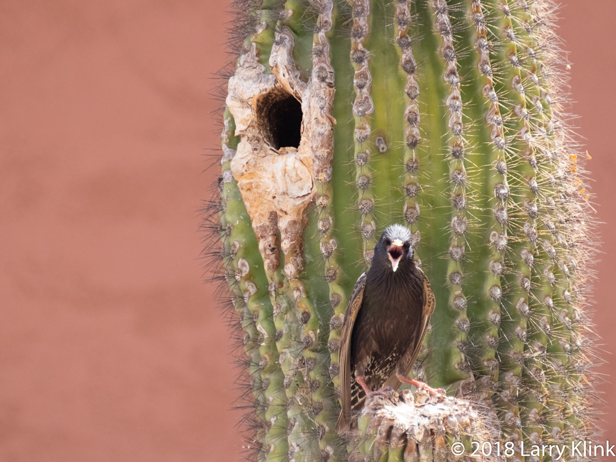
I visited Phoenix, AZ recently. I stayed at a beautiful place at the foot of South Mountain. The place had a patio that overlooked the city and at the corner of that patio was a large saguaro cactus. The mornings were beautiful, so I sat on the deck and watched the birds as they visited the cactus. Here is some of what I saw.
The starling was not taken on the same cactus. It was sitting outside its nesting hole on a cactus at another location.
Note: Click on caption to see image at a larger size.
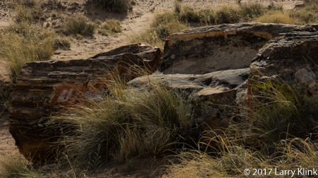
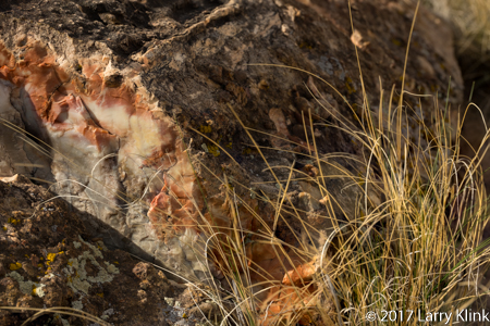
On a recent road trip, we stopped by the Petrified Forest National Park. It was another of the amazing wonders that are our National Parks. Sitting among the beautiful desert landscape are remnants of trees that thrived 200 to 225 million years ago. What we see today is not the tree itself, it is a fossil. The living cells have long since decayed and been replaced by silica, calcite, pyrite, or another inorganic material such as opal. What is fascinating is that the remains look like sections from a tree; including the bark. The result is a stunning fossil rich in color. The park is near Holbrook, AZ, not far off I-40. A casual tourist can get a good view of the park in a few hours. I am looking forward to returning for a few days to enjoy the trails and do some more photography.
I hope you enjoy these images. Please click on caption to see image in larger size.
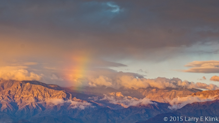
In October, 2015, Donna and I made a tour of the Great Basin area in Nevada. I recently revisited the images I took during that trip and decided to get them ready to publish. The first image is of a special Joshua Tree forest. It is special because, over the mountains,behind the forest, lies Groom Lake, the fabled Area 51. I wonder what you’d see if you were a bug on one of the trees. The second image is of a rainstorm over the desert. It is raining in the distance as crepuscular rays cast their beams over the desert landscape. The third image is a rainbow over Death Valley. I’ve published a version of this image before but wasn’t happy with it. Now it’s back and will be one of the images featured in my show at ACAI Gallery and Studios beginning December 17. The fourth image is one of Mesquite Dunes in Death Valley. It too will be displayed in my show.
My wife, brother, sister-in-law and I took a trip to the Eastern Sierra and the desert of the Great Basin. I remember a trip to Yosemite and down Rte. 395 seeing the snow capped Sierra for the first time. It was an incredible experience. In the intervening years we have experienced drought. The snow left the mountains early causing the rivers to slow early. The beauty is always there but, it’s not as spectacular as when we get lots of snow and rain. This year we got a respite from the drought so the drive down 395 regained much of its splendor. We were treated to scenes from romantic westerns; large mountain valleys, ringed with high snowcapped peaks, cattle grazing on lush green grass. I felt like I should be on a horse with Hoss and Little Joe. The rivers were running hard, churning white water that glistened in the sun. At Yosemite, the waterfalls thundered.
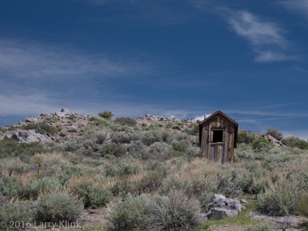
As we travel south on Rte. 395 we reach a point where the terrain transitions from mountain valleys to the valleys of the high desert. The grass goes away and is replaced by gnarled shrub. Even the vegetation along the rivers is stunted. With this year’s rain and snow, the area took on a different look. The wildflower blooms in Bodie were near their end but, stalks retained their spring green, creating a strong contrast against the brown buildings and deep blue sky.
Outhouse on a Hill, Bodie, CA, MAY 2016
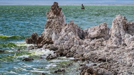
Mono Lake had a hue of emerald green instead of aqua. The lake color, along with the spring greens of its vegetation gave the tufa a softer, cooler gray color and gave a green cast to the air. The winds were very strong that day. They created white caps along with waves that crashed against the tufa and broke along the shore.
Mono Lake, South Tufa Reserve, May 2016
The strong winds followed us to the Ancient Bristlecone Pine Forest where we had planned an early morning hike along the Methuselah Trail. We had to cancel the hike because the wind chill was really bad. We hiked the shorter Discovery Trail instead. The trail was clear but snow patches dotted the adjacent hillsides. The sun peeked through openings in the overcast sky highlighting the sculptural bristlecones and the mountains in the distance.
Schullman Grove, Ancient Bristlecone Pine Forest, MAY 2016
From the bristlecones, we made our way to Death Valley. Spring was in the desert air also. Wildflowers of yellow and white were in bloom along the road. The Joshua Trees were budding but not quite ready to open. Even the cholla cactus was putting on its spring display.
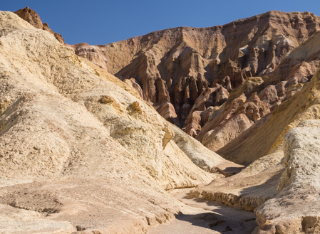
My brother and sister-in-law were taken aback by Death Valley. Like me, they were raised in the eastern US. We saw deserts only in movies. They were areas where sand dunes stretched from horizon to horizon; a place where people rode camels and hung out at an oasis with palm trees. Instead, Death Valley is a typical valley in the basin and range ecosystem. It is long and narrow and ringed with high mountains. It’s hard, gray-brown soil is dotted with gnarled vegetation and rocks that washed down from the mountainsides during storms. But even it was showing signs of spring. Some of the normally dry playas contained water. Tiny wildflowers, mostly yellow, were in bloom. We hiked back Golden Canyon and we watched a sunrise at Zabriske Point. The strongly eroded mountainsides, painted by mineral deposits are always a treat to see especially under the golden sunlight of a sunrise from Zabriske.
Golden Canyon, Death Valley National Park, May 2016
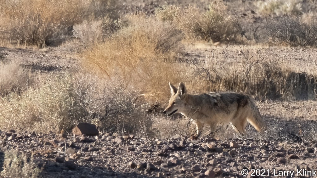
We continued our journey to Lone Pine, CA. Along the way, we chuckled at 2 coyotes working the tourists at a pull-off in Panamint Valley – Will pose of food.
The Alabama Hills are located near Lone Pine. They are oddly eroded, twisted rocks, at the base of Mt Whitney. They were used as the set for many Hollywood productions of western and other adventure movies. Those of us who were fans of Roy Rogers, Gene Autrey, Hopalong Cassidy and the other cowboy protagonists of our childhood would find those hills familiar. Lone Pine also houses the Lone Pine Film History Museum. It holds memorabilia from movies produced in that area. It was fun to see the fancy saddles and guns, stagecoaches and even some monsters and space aliens. It was fun to reminisce also.
The final part of this journey took us to Yosemite. Our plans were to go across Tioga Pass but a snowfall the night before closed it. We had to detour. The detour took us on Rte. 88 from Sorenson’s to Jackson; a stretch we’ve never driven. It was a beautiful drive over granite balds, along steep sided canyons and past mountain lakes. We found a new place to explore for photo opportunities.
Yosemite is at its most beautiful in the spring. Waterfalls thundered, the Merced River churned white water, ephemeral waterfalls were still flowing. We were only able to visit the valley. Even Glacier Point was closed due to “impending storm”. But wondering through the valley is a joy. The immense scale, with waterfalls crashing over sheer granite cliffs towering 3,000 feet and more above your head, drive home the power and awesomeness of nature’s forces and God’s creativity. I am always awe-struck by its beauty. It never gets tiring.
Bridal Veil Falls, Yosemite National Park, May 2016
I hope my images and words give you a sense of spring in Northern California. Stay tuned for Part 2 of our adventure.