Atlanta Snow Birds

A Northern Cardinal, a medium sized red bird with a dark colored face and dark, folded, wings on the left side of the picture. The background is white snow with scattered dark pieces of debris.
Male Northern Cardinal;
Roswell, Georgia, USA; JAN 2025

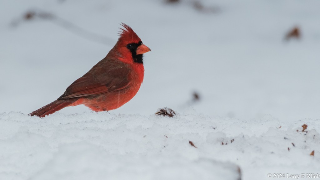
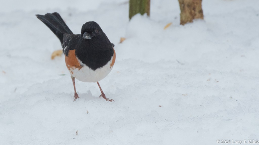
A few weeks ago, we got several inches of snow across the Atlanta, Georgia, USA metropolitan area. I took advantage of this uncommon occurrence to photograph some of the birds that reside here.

Please click on caption to see photos in higher resolution.

A female Northern Cardinal, perched on a piece of wood lattice in front of a tree trunk. The bird is in the middle of the right side of the image. The bird is mostly light brown with red on its wing, feathers and the crest on top of its head. The background on the left side of the picture is indistinct.
Female Northern Cardinal;
Roswell, Georgia, USA; JAN 2025
A male Eastern Towhee, a medium sized bird on the left side of the image facing front. Its head, upper body and tail feathers are black. Below the black, the body is orange. The bottom of is body is white. The bird is set against a background of white snow with scattered debris and two tree trunks.
Male Eastern Towhee;
Roswell, Georgia, USA; JAN 2025

Please visit my website, www.earthwatcher.us to see my collection of landscapes and wildlife.

These and other images are available to purchase by contacting larry.klink@earthwatcher.us.

Sunrise Over a Foggy Valley

Sunrise Over Foggy Valley – Perspective 1
Rattlesnake Edge Trail Overlook, North Bend Area, Snoqualmie Region, Seattle, Washington, USA; NOV 2023

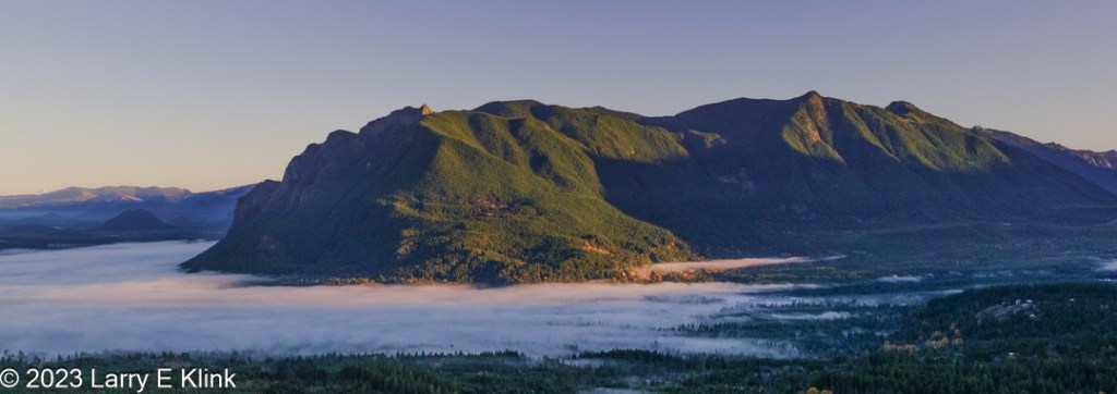
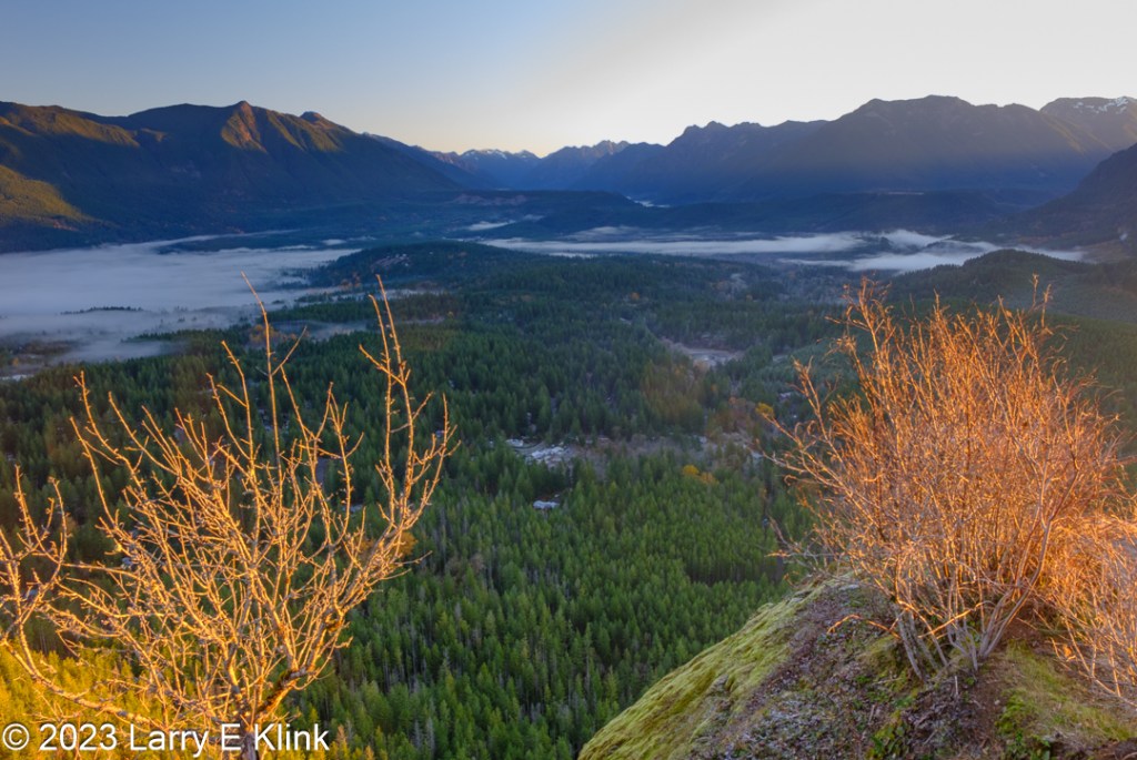
I was visiting my family in the Seattle area. One day we got up early and went to a spot with great views of mountains and a valley. The only issue was that we were in the valley and had to hike 2 miles up the mountain in order to get to the overlook.

The Rattlesnake Edge Trail is a trail cut into the side of a steep mountain lying in its angle of repose. The elevation gain over the 2 miles is 1160 feet. I’m not ashamed to say that it was a tough climb for me, but I made it. We got there about 10 minutes before sunrise.

Please click on caption to see image at higher resolution!

Sunrise Over Foggy Valley – Perspective 2
Rattlesnake Edge Trail Overlook, North Bend Area, Snoqualmie Region, Seattle, Washington, USA; NOV 2023
Sunrise Over Foggy Valley, Perspective 3
Rattlesnake Edge Trail Overlook, North Bend Area, Snoqualmie Region, Seattle, Washington, USA; NOV 2023

Please visit my website, www.earthwatcher.us to see my collection of landscapes and wildlife.

These and other images are available to purchase by contacting larry.klink@earthwatcher.us.

If anyone would like a copy of almost any picture in my library, for educational or research use, please contact me and I will happily share a digital copy with you.

Some Random Birds

Oak Titmouse Near Nest Cavity
Effie Yeaw Nature Center, Sacramento, CA; MAR 2021

Here are a few bird images that I haven’t collected into a theme. Regardless, they are beautiful in their own right. I hope you enjoy them.

Please click on caption to see image at higher resolution.

Female Bushtit Collecting Nesting Materials from Spider Web
Effie Yeaw Nature Center, Sacramento, CA; MAR 2021
Lark Sparrow
Sailor Bar, American River Parkway, Fair Oaks, CA; JAN 2021
Great-tailed Grackle
Mather Lake Regional Park, Sacramento, CA; JUN 2020
Female Great-tailed Grackle
Furnace Creek, Death Valley National Park; OCT 2019

If anyone would like a copy of almost any picture in my library, for educational or research use, please contact me and I will happily share a digital copy with you.

Please visit my website, www.earthwatcher.us to see my collection of landscapes and wildlife.

These and other images are available to purchase by contacting larry.klink@earthwatcher.us.

A Few Songbirds

Orange-crowned Warbler
Orangevale, Ca; OCT 2020

I am sharing a few songbirds that I have photographed over the past few months.

Please click on caption to see images at higher resolution.

Savannah Sparrow
Sacramento National Wildlife Refuge, Willows, CA; NOV 2020
Golden-crowned Sparrow
Rollingwood Bluffs, Orangevale, CA; NOV 2020
Oak Titmouse
Sailor Bar American River Parkway, Fair Oaks, CA; NOV 2020
Lesser Goldfinch
Sacramento National Wildlife Refuge, Willows, CA; NOV 2020

Please visit my website, www.earthwatcher.us to see my collection of landscapes and wildlife.

These and other images are available to purchase by contacting larry.klink@earthwatcher.us.

Scenes from the Eureka Valley

Desert in Autumn
Eureka Valley, Death Valley National Park, CA; OCT 2020

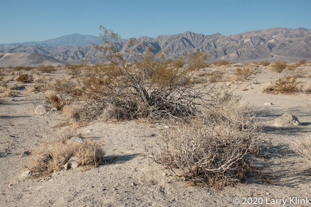
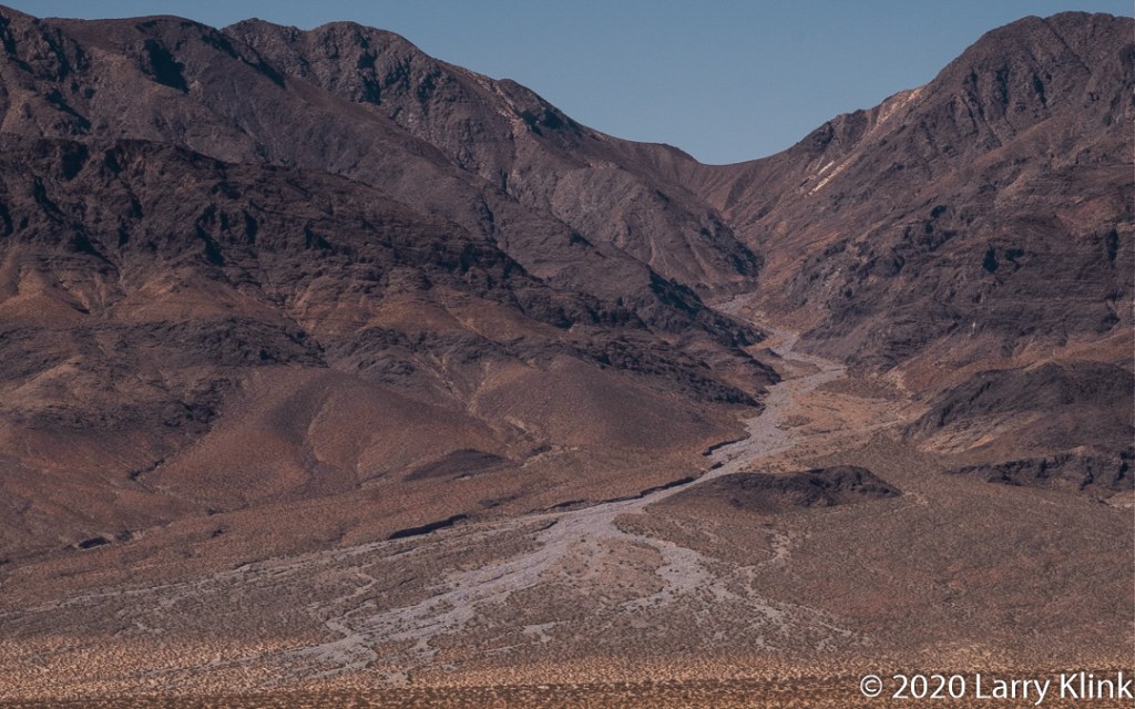
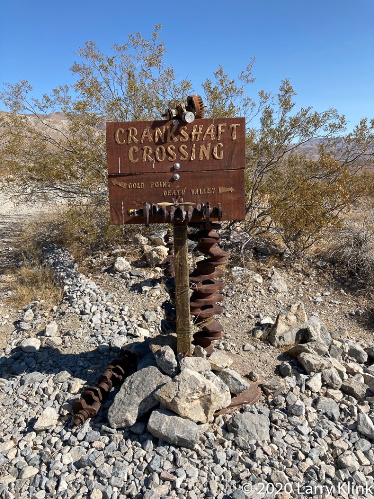
On our last trip to the Eastern Sierra, we explored Big Pine – Death Valley Road. Twenty-five miles from Big Pine, CA, the pavement ends, and you enter Death Valley National Park.  The route took us through Eureaka Valley, over the Last Chance Mountains to Crankshaft Crossing where we made a right to continue on Death Valley Road. That led us to Ubehebe Road then to Scotty’s Castle Road and further to Stovepipe Wells. It was a fun trip through beautiful desert despite the tire shredding rocks and washboard grating on the road. If you ever take this route be careful. Have really good tires and plan your timing; there are many washes that cross the road. They were all in good repair when we took the trip in early autumn. But, they could be bad in other times of the year.

Please click on caption to see image at higher resolution.

A Sunrise in Eureka Valley
Eureka Valley, Death Valley National Park, CA; OCT 2020
View From a Wash
Eureka Valley, Death Valley National Park, CA; OCT 2020
A Wash on a Fan; Last Chance Mountains
Death Valley National Park, CA; OCT 2020
Crankshaft Crossing
Death Valley, Death Valley National Park, CA; OCT 2020

Please visit my website, www.earthwatcher.us to see my collection of landscapes and wildlife.

These and other images are available to purchase by contacting larry.klink@earthwatcher.us.

Photographing a Burn Scar

A Mountain Woodland
Rt 89 above Topaz, CA; SEP 2020

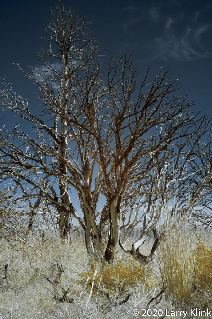
On our day trip to the mountains, we decided to visit and photograph a burn scar; a section of burned forest from a fire a few years ago. The burned trees were intriguing with their swirls of white wood and black charred wood. The grasses had repopulated the area and the Rabbit Brush was blooming. It was a fun time.

Please click on caption to see image at higher resolution.

Scene from an Old Burn Scar
Rt 89 above Topaz, CA; SEP 2020
Scene from an Old Burn Scar
Rt 89 above Topaz, CA; SEP 2020
Scene from an Old Burn Scar
Rt 89 above Topaz, CA; SEP 2020
Scene from an Old Burn Scar
Rt 89 above Topaz, CA; SEP 2020
Scene from an Old Burn Scar
Rt 89 above Topaz, CA; SEP 2020

Please visit my website, www.earthwatcher.us to see my collection of landscapes and wildlife.

These and other images are available to purchase by contacting larry.klink@earthwatcher.us.

The Tricolored Heron

Tricolored Heron (Egretta tricolor)
Merritt Island National Wildlife Refuge, Titusville, FL; FEB 2020

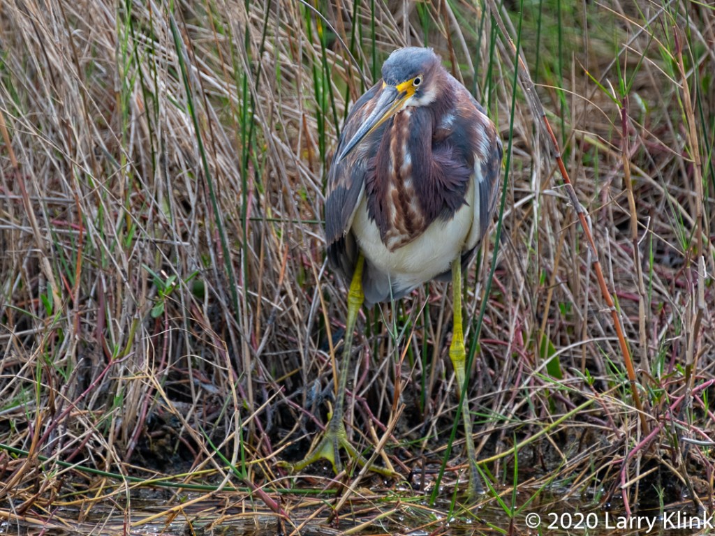
The Tricolored Heron is an amazingly beautiful, small heron – up to 30” tall. They are found, year-round in Florida and along the US Gulf Coast. During nonbreeding periods, they can also be found along the Pacific Coast of Southern California and Mexico as well as parts of Central America. They breed in areas of North Florida. They like the coastal estuaries, saltmarshes, mangrove forests and lagoons.

Tricolored Herons prefer to eat fish from brackish waters. They stalk and attack like other herons and egrets with a few minor uniqueness’s. They nest in colonies with other herons and egrets.

All About Birds from Cornell Labs posted an interesting observation about the Tricolored Heron: “Angsty teenagers aren’t just a human phenomenon. As Tricolored Herons get older they often lunge and snap at their parents when they arrive at the nest with food. To appease the youngsters, parents greet them with bows.”

I was amazed when I first saw one of these birds. I think all herons and egrets are beautiful but, for me, this one tops the list.

Note: Click on caption to see image at higher resolution.

Tricolored Heron;
Harns Marsh, Fort Meyers, FL; FEB 2020
Tricolored Heron;
J N “Ding” Darling National Wildlife Refuge; FEB 2020
Tricolored Heron;
Merritt Island National Wildlife Refuge, Titusville, FL; FEB 2020
Tricolored Heron;
Merritt Island National Wildlife Refuge, Titusville, FL; FEB 2020

Please visit my website, www.earthwatcher.us to see my collection of landscapes and wildlife.

These and other images are available to purchase by contacting larry.klink@earthwatcher.us.

Mountain Peaks Along US Route 395 in the Eastern Sierra Nevada

Mountain Peak Along Eastern Sierra – P3 Owens River Road
Lee Vining, CA; OCT 2019

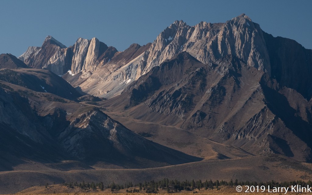
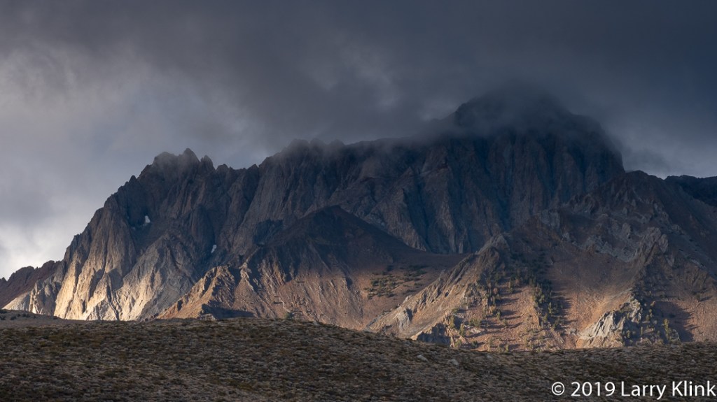
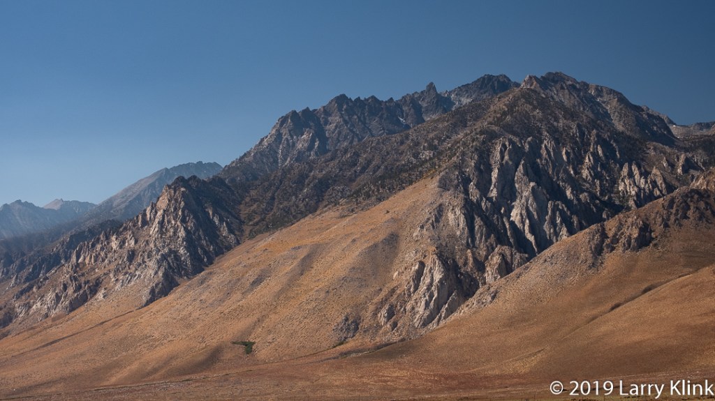
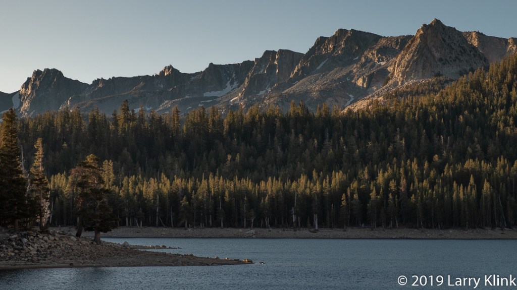
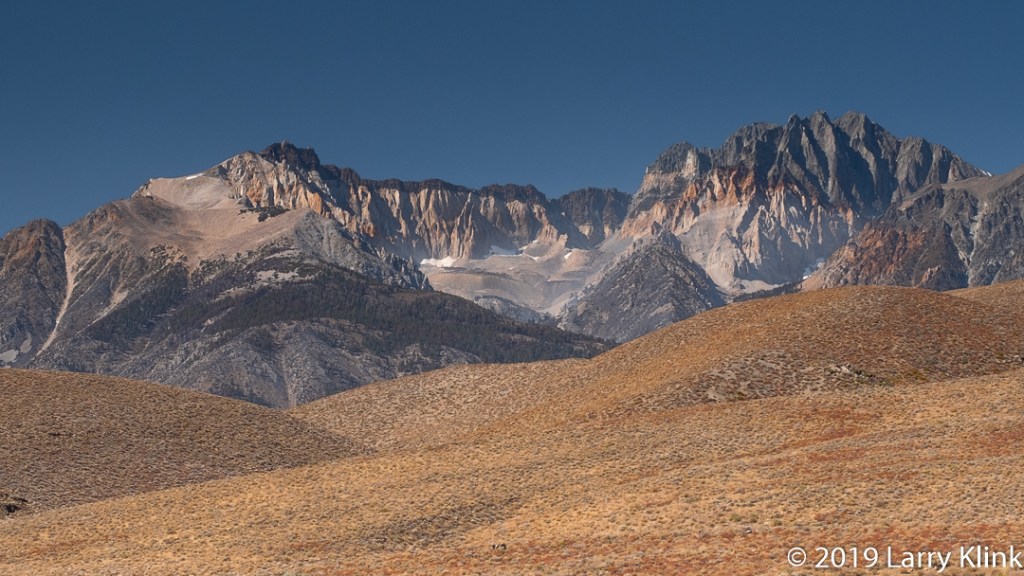
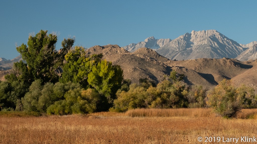
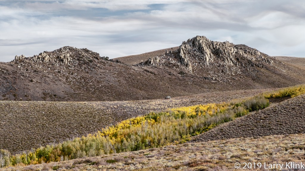
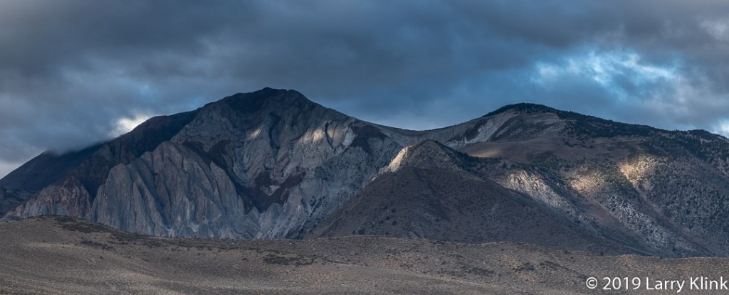
Today I am sharing images of various mountain peaks we see as we travel along US Route 395 in eastern California. Highway 395 extends from the US-Canada border to its southern terminus in the Mojave Desert at I-15 near Hiperia. Much of its way through California it traverses desert valleys sandwiched between the Sierra Nevada mountains and the White-Inyo mountains. It is absolutely stunning scenic drive. For the adventurous, there is mountain hiking and climbing and fishing. There are back road drives into the mountains to scenic lakes and great vistas. There are attractions like Mono Lake with its Tufa, the Ghost Town Bodie, The Ancient Bristle Cone Pine Forest, the museum and remains of the Manzanar Internment Center from World War 2 and the Movie Museum in Lone Pine. If you’ve never explored this area, I strongly recommend you check it out.

Note: Please click on caption to see image at higher resolution.

Stormy Sunrise from Mt Morrison Rd; Mt Morrison Rd
Mammoth Lakes, CA; OCT 2018
Mountain Peak Along Eastern Sierra – P2;
Rt 395 Between Bishop and Fort Independence; OCT 2019
Sunrise at Horshoe Lake; Horseshoe Lake
Mammoth Lakes, CA; OCT 2019
Mountain Peaks from Tule Elk Viewing Area on Highway 395
Rt 395 Between Bishop and Fort Independence; OCT 2019
View from Pleasant Valley Dam Road
Pleasant Valley Dam Road, Bishop, CA: Oct 2019
Autumn Color Along Dunderberg Meadow Road
Dunderberg Meadow Road, Virginia Lakes, CA; OCT 2019
Mountain Peak Along Eastern Sierra – P1
Mt Morrison Rd, Mammoth Lakes, CA; OCT 2018

These and other images are available to purchase on my website: www.earthwatcher.us or by contacting larry.klink@earthwatcher.us.

A Spring Morning on the Cosumnes River

Cosumnes RIver, North Fork
A Spring Morning on the Cosumnes River – Perspective 1 Bucks Bar Road, Somerset, CA

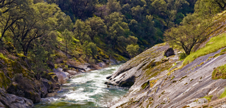
My wife, my mother and I decided to visit Daffodil Hill, a beautiful spring attraction in Amador County, CA.  After the visit, we decided to wander some of the lesser traveled roads in rural El Dorado and Placer counties; an area where my wife spent a lot of time during her childhood.  As we wandered, we crossed a small bridge spanning the North Fork of the Cosumnes River.  The Cosumnes is a 52 mile long river starting as 3 forks in the Sierra Nevada, eventually merging with other rivers and flowing into the San Francisco Bay by way of the Sacramento/San Juaquin delta.  We were somewhere along the North Fork near Somerset, CA.  The recent rain and snow, brought on by the El Nino, has given us a brief respite from the years of drought.   The river was flowing rapidly through this shallow gorge.  The morning sun filtered through the forest, highlighting the bright spring green of life reawakening.

I hope you enjoy these 2 perspectives of this beautiful canyon.

Cosumnes RIver, North Fork
A Spring Morning on the Cosumnes River – Perspective 2

These and other imageas are available to purchase on my website: http://www.earthwatcher.us or by contacting larry.klink@earthwatcher.us.

Regards,

Larry


Pintail Duck

Pintail Duck
Pintail Duck, Cosumnes River Preserve, Sacramento, CA DEC 2015

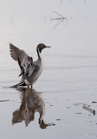
We are very lucky to be near the delta that flows into San Francisco Bay because it attracts many beautiful migrating birds in the winter. One of the birds that makes California’s Pacific Flyway their home is the Pintail Duck. I shot this image of a beautiful pintail Sunday morning, DEC 27, 2015.