Island Ford, Chattahoochee River National Recreation Area, Sandy Springs, Georgia, USA; AUG 2025
Click on caption to see image at higher resolution.
Click on caption to see image at higher resolution.

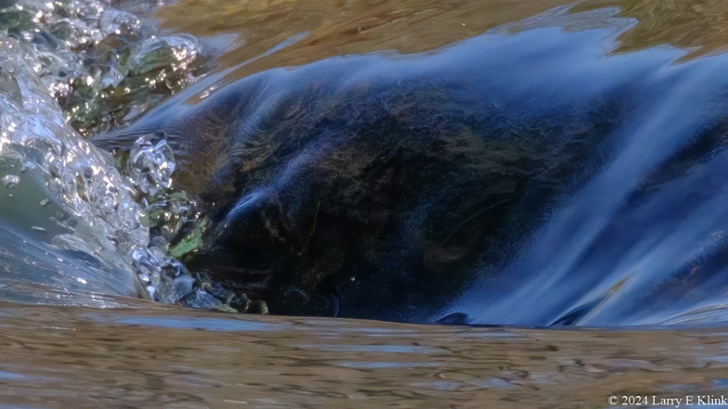
I was walking a trail along the Chattahoochee when I spotted a small but beautiful cataract. The light was great. Serendipity happened.
Please click on caption to see image at higher resolution!
Please visit my website, www.earthwatcher.us to see my collection of landscapes and wildlife.
These and other images are available to purchase by contacting larry.klink@earthwatcher.us.
If anyone would like a copy of almost any picture in my library, for educational or research use, please contact me and I will happily share a digital copy with you.
#Photography #Photographie #PhotosOfTheDay #fujilove #fujixt #nature #naturephotography #landscape #landscapephotography #landscapehunter #earth_portraitsp #river #Chattahoochee #Roswell #Georgia

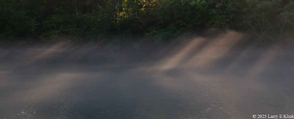
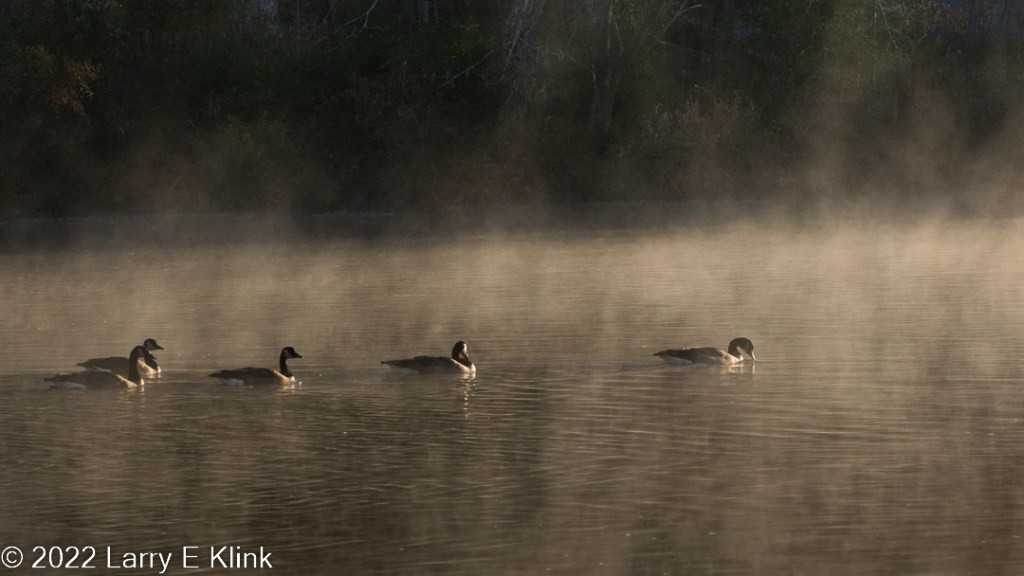
I had a rare morning for one of my hikes along the Chattahoochee River. The sun was popping out from behind the clouds, highlighting little vignettes. It was a wonderful morning.
Please click on caption to see image at higher resolution!
Please visit my website, www.earthwatcher.us to see my collection of landscapes and wildlife.
These and other images are available to purchase by contacting larry.klink@earthwatcher.us.
If anyone would like a copy of almost any picture in my library, for educational or research use, please contact me and I will happily share a digital copy with you.
Meandering up the river at sunrise.
Please click on caption to see image at higher resolution.
Please visit my website, www.earthwatcher.us to see my collection of landscapes and wildlife.
These and other images are available to purchase by contacting larry.klink@earthwatcher.us.
If anyone would like a copy of almost any picture in my library, for educational or research use, please contact me and I will happily share a digital copy with you.
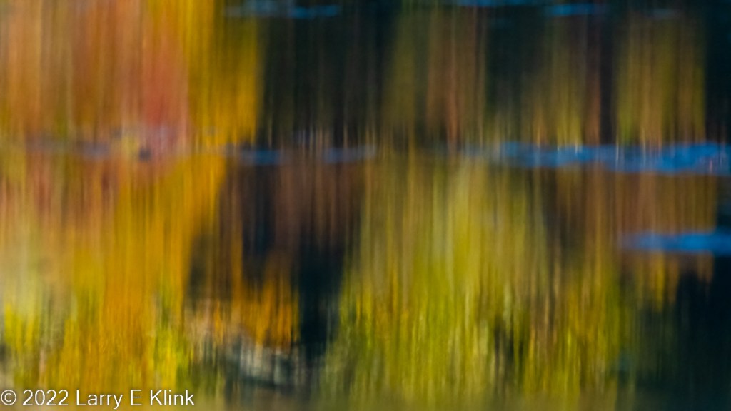
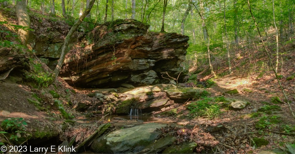
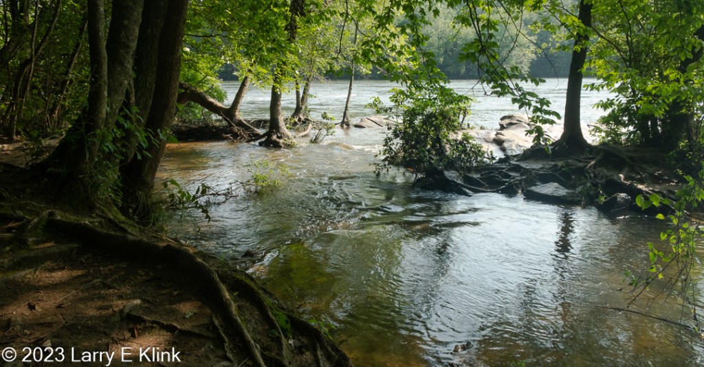
This past week I walked in the forests along the Chattahoochee River. Autumn colors were just starting to appear. The sun was shining allowing beautiful reflections to appear. Leaf color is a prime feature of autumn but its more than just the leaves on the trees. I was blessed to have nature share with me the abstracts she painted in the river.
Please click on caption to see image at higher resolution.

Please visit my website, www.earthwatcher.us to see my collection of landscapes and wildlife.
These and other images are available to purchase by contacting larry.klink@earthwatcher.us.
If anyone would like a copy of almost any picture in my library, for educational or research use, please contact me and I will happily share a digital copy with you.

Please click on caption to see picture at higher resolution.
Today I am sharing a picture of a beautiful waterfall that is very near where I live. Its in a tiny, picturesque park and sets under a covered bridge. My understanding is that the waterfall is man-made, and the bridge is recent. It is very well done. It is on Big Creek, once known as Vickery Creek.
Please visit my website, www.earthwatcher.us to see my collection of landscapes and wildlife.
These and other images are available to purchase by contacting larry.klink@earthwatcher.us.
If anyone would like a copy of almost any picture in my library, for educational or research use, please contact me and I will happily share a digital copy with you.
Photography #Photographie #PhotosOfTheDay #fujilove #fujixt #nature #naturephotography #landscape #landscapephotography #landscapehunter #earth_portraitsp #ig_landscape #Roswell #Georgia #USA #waterfall
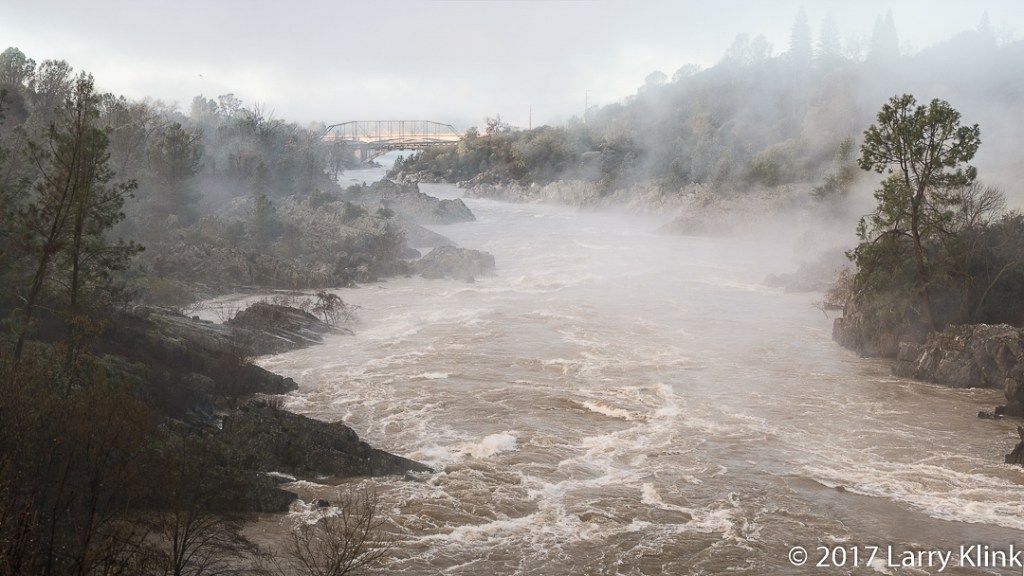
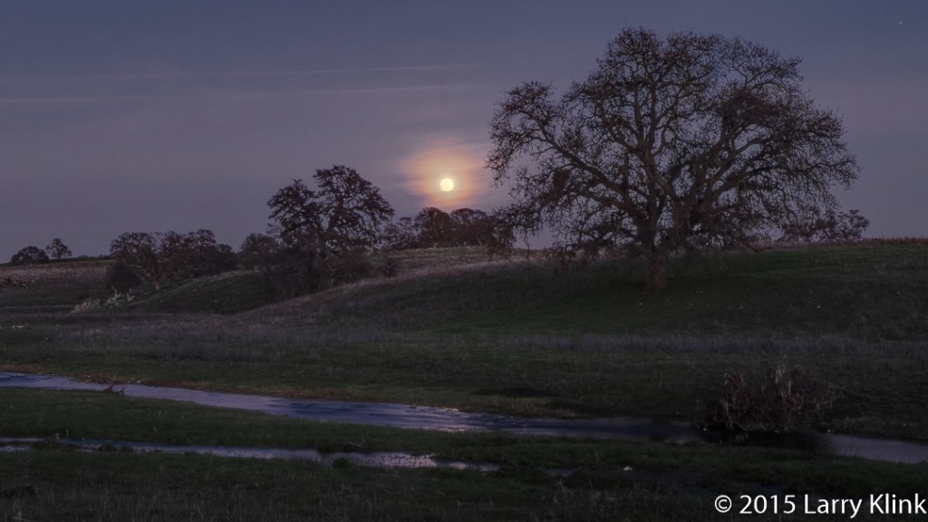
Today I decided to share a few scenes from the area around Folsom, CA. Folsom is the site of the Folsom Prison that Johnny Cash put on the map. But there is more. It sits along the American River near the western end of the Sierra Nevada foothills. The small section of old town Folsom is still very nice. The outskirts are surrounded by oak woodlands primarily used for ranching.
Note: Please click on caption to see image at higher resolution


Please visit my website, www.earthwatcher.us to see my collection of landscapes and wildlife.
These and other images are available to purchase by contacting larry.klink@earthwatcher.us.

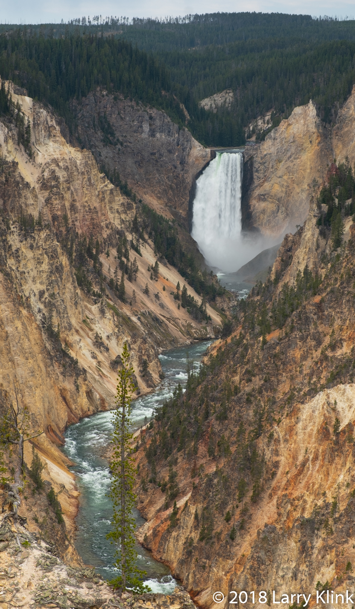
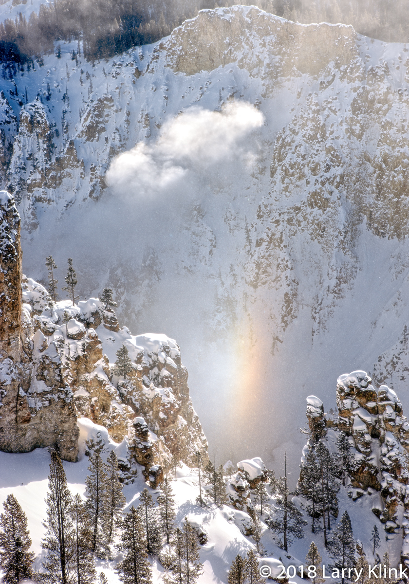
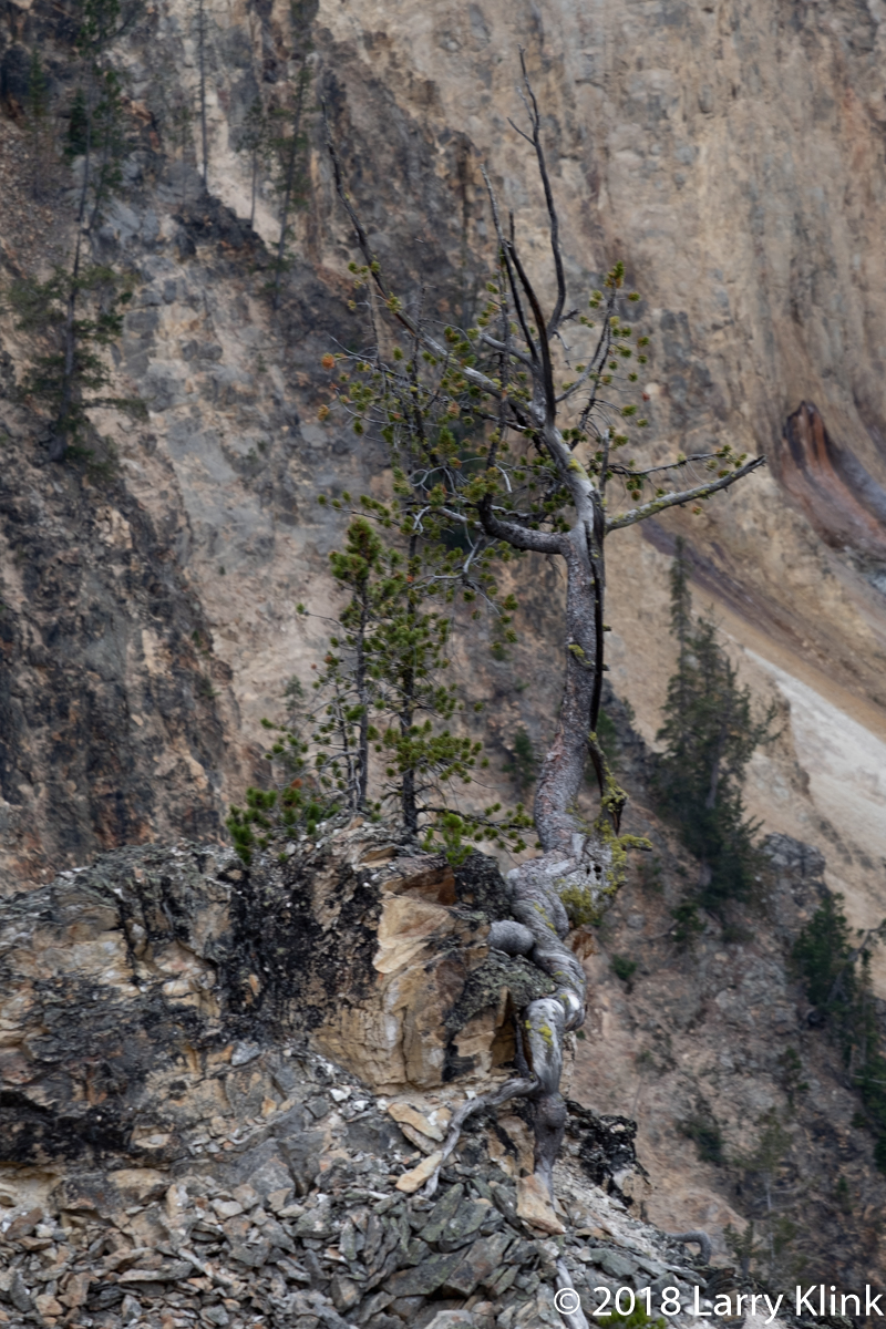
The Grand Canyon of the Yellowstone is another one of Yellowstone National Park’s iconic features. The steep, rugged canyon is cut through volcanic rocks that are colored by deposits of iron. It is being cut by the Yellowstone river which, in other parts of the park, seem calm and serene. But, in the canyon, it is a raging torrent. It tumbles down over Upper Yellowstone Falls (109’) then, after a short distance, tumbles over Lower Yellowstone Falls (308’). After the falls, the river flows its way alongside fumaroles and over cascades as it winds its way through the canyon.
Most of these images are from a recent trip. But I decided to include 3 from previous trips to give you some other perspectives of the canyon. They are Bottom of Lower Yellowstone Falls with rainbow like color, The Beam, a unique winter phenomenon and Lower Yellowstone Falls in Winter by the Light of the Full Moon.
Regards,
Larry
Note: Click on caption to see image at higher resolution


Notr: These and other images are available to purchase at my website: www.earthwatcher.us or by contacting larry@earthwatcher.us

Politically, Iceland is considered part of Europe. Geologically, though, it is a very different situation. Iceland sits atop the mid-Atlantic ridge. The ridge is a chain of volcanic mountains, mostly under the Atlantic Ocean that stretches most of the way between the North and South Poles. It is the dividing line between the Eurasian and North American tectonic plates. As the volcanos erupt, the lava causes the Atlantic Ocean to become wider, pushing North and South America westward and Europe and Africa eastward.
The Almannagjá Ravine is a crack or rift between the North American and Eurasian plates that is located in Þingvellir National Park It is a small part of the section of the mid-Atlantic ridge that runs northeast to southwest through Iceland. It geologically, marks the boundary between Europe and North America.
These images were taken in the Almannagjá Ravine. As you look at them, the walls to the left are in Europe and those on the right are in North America. For geology geeks like my wife and I, it is truly amazing to be able to stand on the mid-Atlantic ridge and to be able to walk between Europe and North America.
In 930, Iceland established its parliament in Þingvellir, near this location. Sessions were held there until 1800.
I hope you enjoy these images.
Regards,
Larry
Note: Click on caption to see images in higher resolution and larger size.


These and other images are available to purchase at my website www.earthwatcher.us or by contacting larry@earthwatcher.us