Glaciers and Icebergs


Image of a tongue of Vatnajökull Glacier
Vatnajökull Glacier, Near Hof, Iceland; SEP 2017

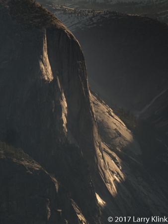
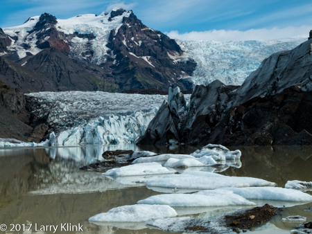
Long ago, I heard the quip that Greenland is icy and Iceland is green. I’ve never been to Greenland but can attest that, at least in the late summer, Iceland is very green. That being said, there is a lot of ice in Iceland. Iceland bills itself as the land of fire and ice because of the many glaciers and volcanos. In the area we travelled, we saw the glacier capped peaks anywhere there was a break in the cliff sides or where the cliff sides were set back far enough that we could see above them. Some were so large, you can see them cover peak after peak for many miles. In places, their tongues would wind their way down mountain valleys, sometimes reaching the floor. I have seen glaciers on TV and have heard about the dangerous crevices but it was not until this visit that I was able to follow a glacier, with my eyes, and see that it not just a smooth icy crust, but rather a cragged set of peaks and crevices. Perhaps, when there is a lot of snow, it fills the crevices making the glacier appear smooth and making it a much more dangerous place to cross.

Several things intrigued me about the glaciers I saw: some of the ice is white and some of it is blue, there were big black stripes over the glaciers and several of the glaciers sat atop volcanos, 2 of which erupted recently. The blue ice is caused by how some of the ice crystals react with light. The black stripes are windblown particles of volcanic ash that cover the glacier in the summer. In the winter, they are mostly covered with snow.

Volcanos under ice is the interesting story. Eyjafjallajökull, a volcano under a glacier of the same name, erupted in 2010. Grímsvötn, a volcano under Iceland’s largest glacier, Vatnajökull, erupted in 2011. Katla, which is partly covered by Mýrdalsjökull is currently threatening eruption and may be a much larger than the others in recent history. (By the way, jökull means glacier in Icelandic.) In addition to the explosive action of the eruption, it can melt the snow and ice creating catastrophic water and mudflows called lahars. The eruption of magma, the lava flows and the lahars will reshape a landscape. Because Iceland has so many volcanos that are active, fire and ice are responsible for Iceland’s rugged beauty.

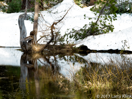
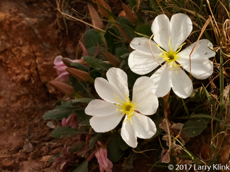
Between the eruptions, the glaciers provide the water for the many waterfalls and the lush, green, vegetation and wildflowers. Where the glacial tongues reach the plains, they calve icebergs into lagoons. At one of the most popular lagoons, Jökulsárlón, a short river provides an outlet for the icebergs to flow to the ocean as the tides recede. When the tides return, many of the icebergs wash back onto the black sand beach. It is a wonder to behold.

I hope you enjoy the images of Glaciers and Icebergs.

Note: Click on caption to see image in larger size and resolution.

Iceberg; Jökulsárlón Lagoon, Iceland
Iceberg; Blue Ice - Last Light
Iceberg; Jökulsárlón Lagoon, Iceland
Surf and Ice
Surf and Ice, Jökulsárlón Ice Beach
Surf and Ice
Surf and Ice, Jökulsárlón Ice Beach
Vatnajökull Glacier
Vatnajökull Glacier, Near Hof, Iceland
Image of Svinafellsjokulsvegur Glacial Tongue and Lagoon
Svinafellsjokulsvegur Glacier

Regards,

Larry

These and other images are available for purchase at http://www.earthwatcher.us or by contacting larry@earthwatcher.us

An Adventure in Iceland, SEP 2017

20170904-Iceland-Snæfellsnes-181-Web
Coastal Plain, Búðir, Snæfellsnes Peninsula, Iceland; SEP 2017

When I close my eyes and picture Iceland, I think of coastal plains lying between the ocean and tall cliff sides. At some places, the plains are grass covered, at other places they are filled with jagged black lava. The cliff sides are impressively tall and massive. They are green with vegetation and filled with outcrops of volcanic basalt. All along the cliff sides, waterfalls appear at frequent intervals. Free range sheep, in small groups, dot the hillsides. Oceanside beaches are black from the volcanic rock and sand.

Svartifoss (Black Falls)
Svartifoss (Black Falls), Iceland with its well formed Basaltic Columns. SEP 2017

Glacier melt from the ice covered volcanic mountains creates many, many small streams. These streams drop in long thin ribbons of white from the cliffside. Where they hit the plain, they cut small streams that meander their way to the oceans. In September, the streams flow through gullies in their rocky beds. But, I am told, that in the spring the beds are full of raging water. The streams travel short distances so they don’t have time to merge into large rivers. Despite their size, the fall from glacier to ocean gives them a swift current.

Icelandic Sheep
Icelandic Sheep, Snæfellsnes Peninsula; SEP 2017


The plains are used for ranching. A few ranchers have cattle but most raise sheep and horses. Icelandic wool products are sold throughout the country. Lamb is a staple; Icelandic meat soup is very good.

20170903-Iceland-West-047-Web
Icelandic Horse


There are also many horses which are unique to Iceland. They are short, stalky beasts with long, shaggy mains and tails. There is little farming. In fact, we saw only one garden at a home behind a place where we stayed.

Wildflowers and Moss
Wildflowers and Moss, Near Hoffellsjökull, Iceland, SEP 2017


Iceland has a history of recent volcanic activity. So, the rocks are angular and jagged. They haven’t had time to weather into smoother surfaces. But, even in the lava fields, grasses and wildflowers grow between the rocks and gravel. Moss sometimes grows on the volcanic rock giving the lava fields a soft, velvety green color to contrast with its normal black, jagged features.

Mountain Valley
Mountain Valley, Iceland, Þakgil; SEP 2017
Hof Glacial Lagoon and Vatnajokull Glacier
Hof Glacial Lagoon and Vatnajokull Glacier; SEP 2017

As you travel through Iceland, you get glimpses of the massive glaciers that cover many of the mountains. In a few spots, glacial tongues reach the valley floor. Where this occurs, you can see the blue icy edges of the glacier. At the edge, ice breaks loose and falls as icebergs into lagoons. In Jökulsárlón, the icebergs float down a short river and into the ocean where some flow back onto beach.

Highland Valley
Highland Valley Þakgil; SEP 2017


We got to spend precious few hours in the highlands (mountains). One visit took us across a rocky riverbed of gray-green volcanic rock into hills made of broken shards of shale. Shale is sedimentary rock meaning it formed under a calm lake or ocean. It is an anomaly in an otherwise volcanic landscape. A second trip took us to a high valley near one of the glaciers. The valley is reminiscent of those you might see in a medieval fantasy story. The path through the jagged rocks of the tall valley led uphill, next to a stream that cascades from the glacier. The atmosphere was cool and damp. The cliff side was covered with moss and wildflowers.

I’ll be publishing more images focused on different features. Iceland is a remarkably beautiful place. I look forward to visiting again.


Note: Click on caption to see images in a larger size.

These and other images are available for purchase on my website: www.earthwatcher.us or by contacting larry@earthwatcher.us


Lighthouses of America


Lighthouses of America

On August 1st, Welcome Books released Lighthouses of America.  I am pleased to announce that 2 of my images, St Augustine Lighthouse, FL and Point Arena Lighthouse, CA were included in this great book.  Please check it out.

A Special Time in Bodie

Image of Daybreak over Bodie, CA, JUN 2017
Daybreak Over Bodie, CA, JUN 2017

Bodie, CA is a ghost town in east central California. It is a state park whose buildings are kept in a state of “arrested decay”; i.e. as they were when the last residents left. I’ve photographed at Bodie many times because there are so many interesting things to shoot.  About 2 weeks ago, The Bodie Foundation, a non-profit that supports the park, hosted a sunrise shoot for photographers. We were able to get into the park at 5:00AM instead of the normal 9:00AM and, instead of the normal crowds, there were only about 10 of us. It was a marvelous morning; quiet, comfortable temps, and a chance to watch the sunrise play across the town.  I wish I could have cloned myself because there were so many places I would have liked to have photographed simultaneously.  I hope you enjoy these images.

Regards,

Larry

Note: Please click on caption to see image in larger size.

Image of the Ruins of a Storehouse, Bodie, CA JUN 2017
Ruins of a Storehouse
IMage of a Belding's Ground Squirrel, Bodie, CA JUN 2017
Belding’s Ground Squirrel
Image of Bodie Methodist Church at Sunrise, Bodie, CA JUN 2017
Bodie United Methodist Church
Image of Old Mining Equipment: Drive Wheel and Axle, Bodie, CA JUN 2017
Old Mining Equipment: Drive Wheel and Axle
IMage of Main Street Bodie at Sunrise, Bodie, CA JUN 2017
Main Street Bodie at Sunrise
Image of a Black-tailed Jackrabbit, Bodie, CA, JUN 2017
Black-tailed Jackrabbit
Image of Items Through A Window, Bodie, CA Jun 2017
Untitled

These and other image are available for purchase on my website, www.earthwatcher.us or by contacting larry@earthwatcher.us.

A Visit to Yosemite

Image of Yosemite's Half Dome at Sunset
Yosemite’s Half Dome at Sunset

A few weeks ago, we spent an evening and early morning at Yosemite. Water was running everywhere. The Merced River was a raging snake of whitewater. The granite cliffs of Yosemite are amazing anytime but, when they are covered with ribbons of water falling 3,000 feet, it is really amazing.

I hope you enjoy these images.

Regards,

Larry

Note: Click on caption to see image at larger size.

Image of a tree stump reflected in a pond. Glacier Point Road, Yosemite National Park, MAY 2017
Reflection in a Pond, Glacier Point Road, Yosemite National Park, MAY 2017
Yosemite's North Dome in mottled early morning light. MAY 2017
North Dome at Sunrise, Yosemite National Park, MAY 2017
Yosemite's Nevada Falls at Sunset. MAY 2017
Nevada Falls, Yosemite National Park, MAY 2017
Image of a Steller's Jay, Yosemite National Park, MAY 2017
Steller’s Jay, Yosemite National Park, MAY 2017

Birds and Flying Bugs

Image of an Eaglet - Bald Eagle Chick, American River Parkway, Folsom, CA, MAY 2017
Bald Eagle Eaglet

I want to share a few images from some recent walks around the American River Parkway near Folsom, CA. I’ve also included one from Oak Alley Plantation near New Orleans. Nature provides some beautiful creatures for us to appreciate. I hope you enjoy these few.

Regards,

Larry

Note: Click on caption to see image at larger size.

Image of a Female Eastern or Common Pondhawk Dragonfly, Oak Alley Plantation, LA, APR 2017
Eastern or Common Pondhawk
Image of a California Quail, American River Parkway, Folsom, CA, JUN 2017
California Quail
Image of a Northern Mockingbird, American River Parkway, Folsom, CA, JUN 2017
Northern Mockingbird
Image of an Ash-throated Flycatcher, American River Parkway, FOlsom, CA, JUN 2017
Ash-throated Flycatcher
Image of a Spicebush Swallowtail butterfly, American River Parkway, Folsom, CA, JUN 2017
Spicebush Swallowtail
Image of an Eaglet - Bald Eagle Chick, American River Parkway, Folsom, CA, MAY 2017
Bald Eagle Eaglet
IMage of a Spanish Swallowtailbutterfly, American River Parkway, Folsom, CA, JUN 2017
Spanish Swallowtail
Image of a Spanish Swallowtail butterfly, American River Parkway, Folsom, CA, JUN 2017
Spanish Swallowtail
Image of a pair of Tree Swallows, American River Parkway, FOlsom, CA, JUN 2017
Tree Swallows
Image of a California Towhee, American River Parkway, Folsom, CA, JUN 2017
California Towhee


Note: These and other images are available for purchase on my website: www.earthwatcher.us or by contacting larry@earthwatcher.us

Arches National Park

Image of Sand Dune Arch, Arches National Park, UT
Sand Dune Arch, Arches National Park, APR 2017

We took a day on our road trip and spent it at Arches National Park. During an evening and a morning, you can see many of the main attractions but there is a lot to see that require short to moderate hikes. I hope to go back and spend a few days hiking.
The park is located over a geologically unstable salt bed. The movement of the salt bed and the earth’s tectonic forces caused large blocks of sandstone to uplift. Over millions of years, the sandstone eroded forming the arches and rock monoliths we see today. The park service claims more than 2,000 arches; some just a 3 foot opening through a mountain to the largest: 306 feet base to base. There are massive stone walls whose size, shapes and eroded faces bring pagan temples to mind. There were lots of wildflowers and some wildlife.

I left thinking that I’d like to spend time watching the sun, moon and stars rise and set over these geologic wonders. To me, it is a spiritual place. Our mistake was not giving ourselves the time to take in the spirit.

Please click on caption to see image at a larger size.
Regards,

Larry

Image of Courthouse Towers Rock Feature, Arches National Park, UT, APR 2017
Courthouse Towers, Arches National Park, UT, APR 2017
Image of Delicate Arch, Arches National Park, UT, APR 2017
Delicate Arch, Arches National Park, UT, APR 2017
Image of an
An Unexpected Arch, Arches National Park, UT, APR 2017
Image of a rock wall near Sand Dune Arch, Arches National Park, APR 2017
Wall Near Sand Dune Arch, Arches National Park, UT APR 2017
Image of wildflower: Pale Evening Primrose, Arches National Park, UT, APR 2017
Pale Evening Primrose, Arches National Park, UT, APR 2017
Image of Double Arch, Arches National Park, UT, APR 2017
Double Arch, Arches National Park, UT, APR 2017
Image of rock feature: Three Gossips, Arches National Park, UT, APR 2017
Three Gossips, Arches National Park, UT, APR 2017
Image of wildflower: Hedgehog Cactus, Arches National Park, UT, APR 2017
Hedgehog Cactus, Arches National Park, APR 2017

These and other images are available for purchase by visiting www.earthwatcher.us or by contacting larry@earthwatcher.us.

Gettysburg and Antietam

Image of US civil ware era canon in Gettysburg National Military Park
US Civil War Canon, Gettysburg National Military Park, PA APR 2017


We were treated to a tour of both the Gettysburg National Military Park and the Antietam National Battlefield while in Pennsylvania last April.  These are not parks to celebrate and have fun, for how can we celebrate when our principles could only be imposed by slaughtering one another. Instead, they are parks for reflection and to gain insight into the lessons of history. There are plenty of memorials to those who fought; both the dead and the survivors. I chose not to photograph them.  They can be seen online. Instead, I chose to show how nature and humanity has restored the beauty of the countryside – a lesson that time and effort can help us heal.  I hope you enjoy these images.

Please click on caption to see images at larger size.

Regards,

Larry


Image of Burnside's Bridge, Antietam National Battlefield, Sharpsburg, MD, USA
Burnside’s Bridge, Antietam National Battlefield, Sharpsburg, MD
Image of a rail fence near the Lee Memorial, Gettysburg National Memorial Battlefield.
Rail Fence and Pathway, Lee Memorial, Site of Pickets Charge, Gettysburg National Military Battlefield, PA
Image of a wildflower called Star of Bethlehem, Antietam National Battlefield, MD, USA, APR 2017
Star of Bethlehem Wildflower, Antietam National Battlefield, MD
Image of a red tree blossom and small part of a rail fence, near Lee memorial, Gettysburg, PA APR 2017
Blossoming Tree and Rail Fence, Lee Memorial, Gettysburg National Military Park, PA
Image of a stone building near Spangler's Spring, Gettysburg National Military Park, PA APR 2017
Stone Building, Near Spangler’s Spring, Gettysburg National Military Park, PA


These and other images are available for purchase on my website: www.earthwatcher.us or by contacting me at larry@earthwatcher.us


Some Birds From A Recent Trip

Image of Tufted Titmouse
Tufted Titmouse – Cameron, OK MAR 2017

On a recent road trip, we got to see a number of interesting birds that we don’t get to see here in California. We also got to see some of the usual suspects.

Here are some interesting tidbits:

  1. The typical vulture we see in the US is the Turkey Vulture. While the black vulture has a gray head, the turkey vulture  has a red head. The black vulture is found in southeastern US.
  2. The blue jay is found in the eastern half of the US. In the west, we have the scrub jay. The stellar jay and the gray jay are found in areas of the west with cooler temperatures.

Here are images of some of those birds. I hope you enjoy them.

Regards,

Larry

Note: To see the images at a larger size, please click on bird name.

These and other images are available for purchase by visiting www.earthwatcher.us or by contacting larry@earthwatcher.us

Image of a male cardinal
Male Cardinal – Cameron, OK MAR 2017
Image of female cardinal
Female Cardinal – Cameron, OK MAR 2017
Image of red-bellied woodpecker at feeder
Red-bellied Woodpecker – Port St Lucie, FL APR 2017
Image of blue jay
Blue Jay – Cameron, OK MAR 2017
Image of Carolina Wren
Carolina Wren – Cameron, OK Mar 2017
Image of a black vulture
Black Vulture – Port St Lucie, FL APR 2017
Image of sanderling
Sanderling – Port St Lucie, FL APR 2017
Image of a ruddy turnstone
Ruddy Turnstone – Port St Lucie, FL APR 2017
Image of Non-breeding male willet
Willet – Port St Lucie, FL APR 2017
Image of white ibis in Okefenokee Swamp
White Ibis – Okefenokee National Wildlife Refuge, GA APR 2017
Image of a pair of brown pelicans
Brown Pelican – Port St Lucie, FL APR 2017
Image of a pair of wind blown great egrets
Great Egrets on a Windy Day – Bosque Del Apache National Wildlife Refuge, NM MAR 2017
Image of Bald Eagle in a nest
Bald Eagle – Western CO APR 2017

Petrified Forest

Petrified Log
Petrified Log

On a recent road trip, we stopped by the Petrified Forest National Park. It was another of the amazing wonders that are our National Parks. Sitting among the beautiful desert landscape are remnants of trees that thrived 200 to 225 million years ago.  What we see today is not the tree itself, it is a fossil. The living cells have long since decayed and been replaced by silica, calcite, pyrite, or another inorganic material such as opal. What is fascinating is that the remains look like sections from a tree; including the bark.  The result is a stunning fossil rich in color.  The park is near Holbrook, AZ, not far off I-40. A casual tourist can get a good view of the park in a few hours. I am looking forward to returning for a few days to enjoy the trails and do some more photography.

I hope you enjoy these images. Please click on caption to see image in larger size.

Image of section of a petrified log
Close-up of Petrified Log
Image of Desert Grass
Desert Grass

These and other images are available for purchase on my website: www.earthwatcher.us or by contacting larry@earthwatcher.us